Description
Area / Size – Any
Start Date / Month – Any
Certification Need – yes
Service Location – All Over India
Service Mode – Any
Service Duration – 1-12 Months

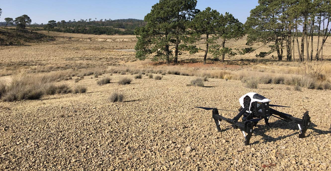
Surveying India provides an effective drone mapping system to capture and process photogrammetric data for mining, construction, agriculture and infrastructure projects using the most advance drone in India. Our design software ensures a cost efficient and time saving solution for rapidly mapping and changes in mining, construction, agriculture and infrastructure applications.


Area / Size – Any
Start Date / Month – Any
Certification Need – yes
Service Location – All Over India
Service Mode – Any
Service Duration – 1-12 Months
| Settings | GIS Survey Service remove | Drone Survey remove | Bridge Survey Service remove | Drone UAV Survey remove | Survey Mapping Drone Service remove | Aerial Contours remove |
|---|---|---|---|---|---|---|
| Image |  |  | 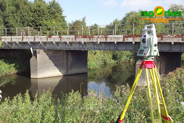 |  | 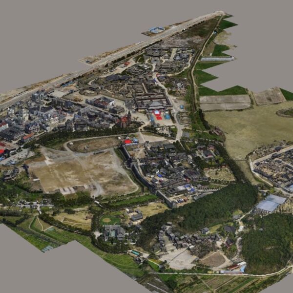 |  |
| SKU | ||||||
| Rating | ||||||
| Price | ||||||
| Stock | ||||||
| Availability | ||||||
| Add to cart | ||||||
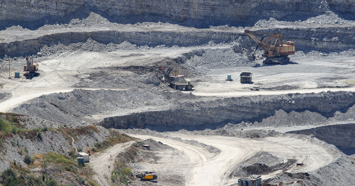
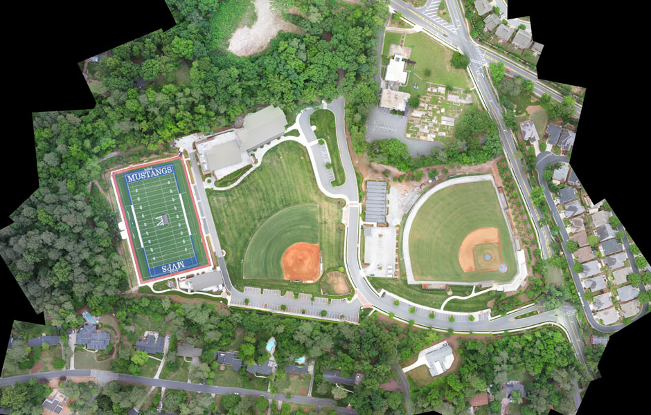
| Description | Surveying India provides an effective drone mapping system to capture and process photogrammetric data for mining, construction, agriculture and infrastructure projects using the most advance drone in India. Our design software ensures a cost efficient and time saving solution for rapidly mapping and changes in mining, construction, agriculture and infrastructure applications. | We provides Drone/Unmanned Aerial Vehicle (UAV) services to both industry and government, covering a wide and varied range of tasks such as UAV inspection and survey, crisis management, radio tower, telecommunications links, industrial building, quarry, wind turbine, chimney, manufacturing works, bridge, rock face or other piece of infrastructure, and also deploy rapid reaction response teams to deal with emergencies and capable to reach places that are difficult, expensive, dangerous, ‘live’ or even impossible to approach by manned inspection teams. | Our organization is offering an assorted range of UAV Survey. We are working dedicatedly to catering to the requirement of the client. Apart from this, our professionals make honest efforts to provide this survey service within the assured set of time. | Surveying India specializes in Aerial Contours. Contour lines are generated by connecting all the points of similar elevation together. These lines are drawn on a plan of a particular terrain to understand the nature of surface, identify cut fill volume, study water flow characteristics, estimate valley depth and steepness. Contour lines form a smooth curve of same elevation points. Contour lines are also called as isohypse, isoline, isopleth, or isarithm. | ||
| Content | Area / Size - Any Start Date / Month - Any Certification Need - yes Service Location - All Over India Service Mode - Any Service Duration - 1-12 Months | Service Type - Survey Mapping Service Location - PAN India Service Mode - Offline | Type - Site Service Mode - Offline | |||
| Weight | ||||||
| Dimensions | N/A | N/A | N/A | N/A | N/A | N/A |
| Additional information |