With the assistance of our enormously competent land diligent team members, we are involved in offering Drone Survey Service. These interior design work services can be offered as per client preferences. Apart from this, we are rendering these services with the help of the latest technology-based resources
With the assistance of our enormously competent land diligent team members, we are involved in offering Drone Survey Service. These interior design work services can be offered as per client preferences. Apart from this, we are rendering these services with the help of the latest technology-based resource
With the assistance of our enormously competent land diligent team members, we are involved in offering Drone Survey Service. These interior design work services can be offered as per client preferences. Apart from this, we are rendering these services with the help of the latest technology-based resources
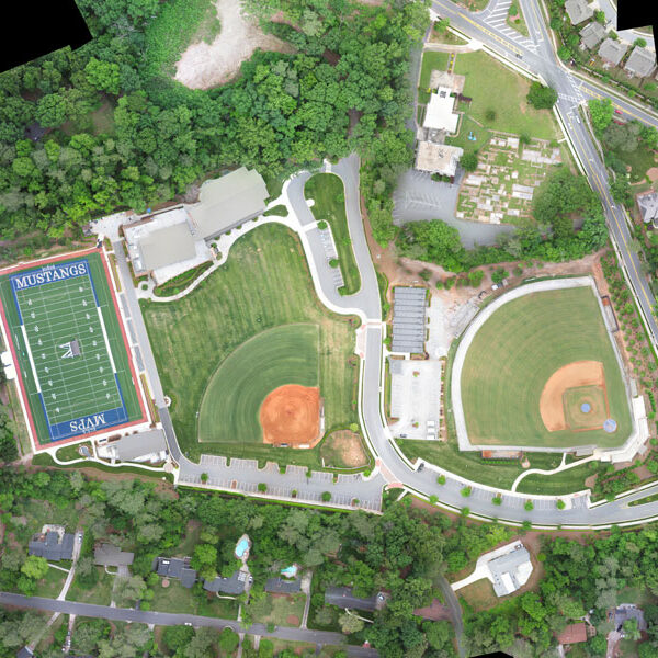
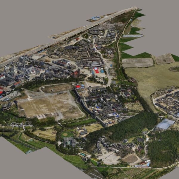
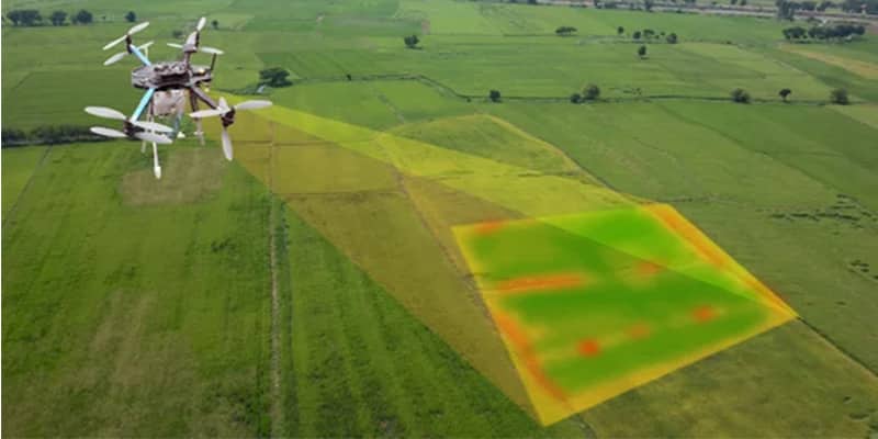
We provides an effective drone mapping system to capture and process photogrammetric data for mining, construction, agriculture and infrastructure projects using the most advance drone currently available in Mumbai, India. Our design software ensures a cost efficient and time saving solution for rapidly mapping and changes in mining, construction, agriculture and infrastructure applications.
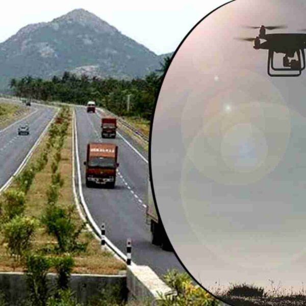
In India, the National Highways Development Project is being carried out to upgrade, rehabilitate and widen major highways to a higher standard. "National Highways" account for only about 2% of the total length of roads, but carry about 40% of the total traffic across the length and breadth of the country. These projects are managed by the National Highways Authority of India (NHAI) under the Ministry of Road, Transport and Highways. We also provide NHAI Road Survey
Surveying India provides an effective drone mapping system to capture and process photogrammetric data for mining, construction, agriculture and infrastructure projects using the most advance drone in India. Our design software ensures a cost efficient and time saving solution for rapidly mapping and changes in mining, construction, agriculture and infrastructure applications.
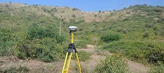
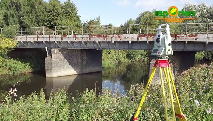
Supported by highly accomplished crew of employees, we are rendering DGPS Survey Service. These provided services are delivered under the stern supervision of adroit personnel as per set industry principles. In addition to this, these provided services are attributed amid our client for reliability and cost effectiveness.
Content
With the assistance of our enormously competent land diligent team members, we are involved in offering Drone Survey Service. These interior design work services can be offered as per client preferences. Apart from this, we are rendering these services with the help of the latest technology-based resource
3D and 2D Mapping
AutoCAD
Visual
Offline
Acre
By Drone
Service Type - Survey Mapping
Service Location - PAN India
Service Mode - Offline
Site Location - All Over India
Area / Size - Any
Is It Mobile Access - Non Mobile Access
Site Location - Pan India
Surveying Location - Pan Location
Service Mode - Offline
Mode Of Report - Hard copy
Scope Of Survey - All existing features
Area / Size - Any
Start Date / Month - Any
Certification Need - yes
Service Location - All Over India
Service Mode - Any
Service Duration - 1-12 Months
Site Location - PAN India
Mode Of Report - Excel
Service Type - DGPS Survey
Service Mode - Offline