“Excellent Work”
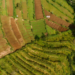
Pixel Vision was approached by a large listed company in May 2022 to carry out drone surveys
compliant with the new IBM regulation. The mines in question were two large limestone mines of
>1,000 hectares and >300 hectares respectively.
“fast quality”
A road survey using a drone was completed for a client named JK Cement Company who
needed DSM and DEM contours as well as a geo-referenced orthophoto and RMSE report.
Consequently, the final output comprises DSM, DEM, a geo-referenced Orthophoto in.jpeg
format, as well as contours for both the DSM and DEM.
“highly recommended”
Amet minim mollit non deserunt ullamco est sit aliqua dolor do amet sint. Velit officia consequat duis enim velit mollit. Exercitation veniam consequat sunt nostrud amet.Voluptate exercitation incididunt magna nulla duis ullamco.