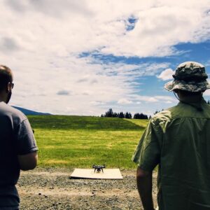
The use of drones in the survey and construction sectors has come a long way and the capabilities of those very drones has seriously improved, making them an essential tool that all surveyors should have in their toolbox. More and more construction sites are taking advantage of drone mapping to improve their speed, quality, and efficiency.
Drone cameras take a series of high-definition photos at different angles, creating thousands of accurate data points, including geo-references, elevation points, and colors. This allows developers to create 3D models of a site or building. Clients can see more than what a traditional survey provides.
Using drones for mapping and surveying offers the following advantages:
- Speed – Drones can scan acres of land in a fraction of the time it takes to manually survey on the ground, especially in areas of challenging terrain.
- Reduced Cost – A drone can capture data faster and safer, which may reduce costs.
- Reduced Operational Risks – The use of drones to capture topographical site data means that surveyors don’t necessarily need to be on-site or in dangerous areas to acquire data, making accessing it safer and easier, especially in hard-to-reach areas.
- Improved Quality of Data – Drones are constantly scanning and creating thousands of measurements, resulting in incredibly detailed and highly accurate point files within a few millimeters, when paired with traditional survey methods.