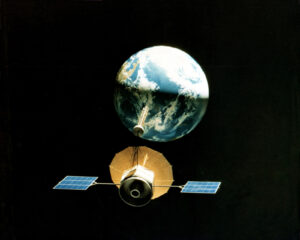
Unlock the economic potential of remote sensing at scale! The past few years have witnessed an explosion in the availability of affordable satellite imagery collected by satellite programs such as Sentinel, Landsat, etc.
This imagery has wide applicability across meteorology, disaster management, environmental management, forest management, agriculture, cartography, urban planning, and several other fields. Imagery collected by satellites can be used to track plant health, monitor deforestation, etc.
There are five types of resolution relevant to satellite imagery in remote sensing: spatial, spectral, temporal, radiometric and geometric.
- Spatial resolution is defined as the pixel size of an image representing the size of the surface area (i.e. m2) being measured on the ground.
- Spectral resolution is defined by the wavelength interval size (can be thought of as colour sensitivity)
- Temporal resolution is defined by the amount of time (e.g. days) that passes between imagery collection periods for a given surface location
- Radiometric resolution is defined as the ability of an imaging system to record many levels of brightness (contrast for example) and is typically expressed in bits
- Geometric resolution refers to the satellite sensor’s ability to effectively image a portion of the Earth’s surface in a single pixel and is typically expressed in terms of Ground sample distance, or GSD.
The resolution of satellite images varies depending on the instrument used and the altitude of the satellite’s orbit. For example, the Landsat archive offers repeated imagery at 30 meter resolution for the planet, but most of it has not been processed from the raw data. Landsat 7 has an average return period of 16 days. For many smaller areas, images with resolution as fine as 41 cm can be available.
In many cases, satellite datasets serve as a cost-effective alternative or complement to other data sources. ‘Nested’ approaches allow satellite data to be combined with other data sources e.g. drone imagery to generate analyses that are more sophisticated than would be otherwise possible.
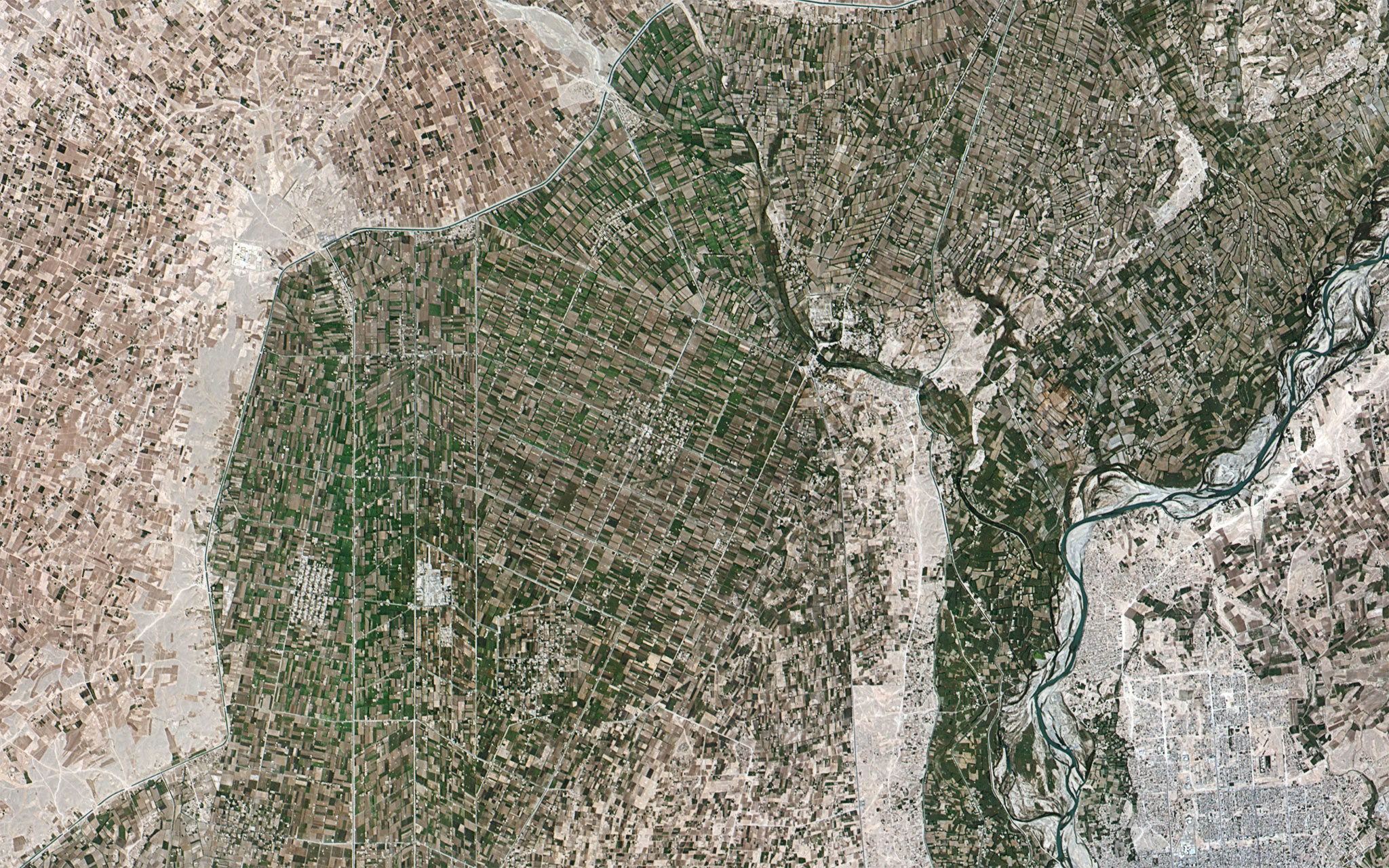
Satellite Services for Agriculture
Easy and cost-effective availability of satellite datasets have ushered in a new era of ‘precision agriculture’. Satellite images ranging from 22cm to a few metres in resolution are processed using Artificial Intelligence (AI), Machine Learning (ML), and Computer Vision (CV) algorithms.
These turn-key analytics enable quantification of biomass or nutrient content, and monitor fields with no bias, free of ground measurement. Combined with agro-meteorological models and established plant health indices such as NDVI, they can be accurately turned into prescriptions to dose fertilisers, water, growth regulators and pesticides. Not only does this reduce the quantity of input required and therefore the cost, it also rationalises inputs and is therefore more environmentally friendly. The resulting output can be used by stakeholders across the value chain to quantify and analyse productivity, plan capex-intensive infrastructure such as irrigation, and also monitor and predict yields.
What’s more, this technology can also play a key role in risk management. Early detection of pest and disease outbreaks allows for rapid action to prevent crop damage and yield loss. Insurance companies globally are also turning to this technology not only to help them monitor/assess risk and determine product pricing, but also to assess damage post adverse events such as cyclones or droughts.
Satellite Services for Forestry
Today, a wide range of governmental, state, and corporate forestry organisations and agencies use geospatial technologies, such as satellite images and GIS (geographic information systems), to support analysis and management of forests.
A key application is in helping authorities respond to emergencies, reduce usage of hazardous fuels, battle fires, and carry out rehabilitation and restoration post adverse events. Data collected by satellites can be used to model fires and therefore to plan mitigation activities such as fire corridors. Satellite imagery is also a powerful tool to monitor forest health through parameters such as density and plant health mapping. Finally, satellites are the single most effective tool to monitor and track deforestation – both planned and otherwise.
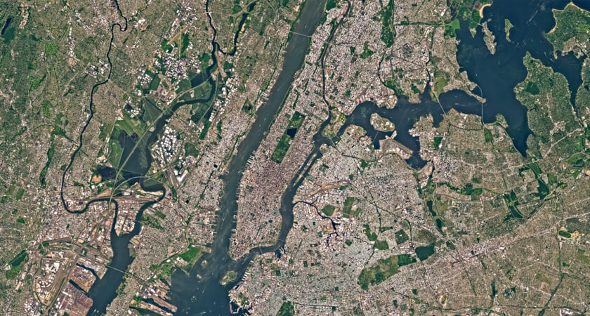
Satellite Services for Urban Planning
In order to create or update GIS maps and detect significant changes in urban land cover and land use, satellite image data can provide detailed data. This enables frequent coverage and the overlaying of various time sequences to monitor the pace and pattern of development.
Additionally, satellites can also be used to help governments with various administrative tasks such as assessing property tax, monitoring urban tree cover, planning transport and infrastructure, etc.
Satellite Services for Infrastructure
Geographic Information Systems (GIS) use satellite imagery as a tool to gather visual data. For certain projects and infrastructure builds, this data is used to foster insightful conclusions that are helpful. There are several applications for this, even if GPS is the most prevalent one. The potential for using satellite imagery in complicated and sophisticated infrastructure projects is growing as it becomes more developed.
Managing high-value and critical infrastructure, reducing costs of asset operations, and ensuring regulatory and safety compliance may require asset-intensive industries to adopt several software solutions for the storage and processing of big data coming from multiple sources. Enhancing these management tools, satellite data, in conjunction with the power of cloud infrastructure, provides an unprecedented opportunity to increase the strength of different applications.
APPENDIX
In “Index drone” under “satellite services,” we combine orthorectified satellite imagery with extracted vector data and client-provided geospatial data to create single, GIS data-rich maps for a variety of industry applications, including agriculture, disaster management, energy, and environmental monitoring. For many different forms of analysis and management relevant to the associated project, we incorporate GIS data to produce a multi-layered outcome. Our GIS mapping services’ knowledge and precision virtually eliminate any potential issues with GIS maps.
In addition to ongoing geodesy, mapping, and ArcGIS 2D geospatial support services for our clients, our team is dedicated to quality control. We make sure that our clients only use the geospatial data sets in the most efficient way possible. We employ constant data quality control on every GIS project, no matter how big or little, to make sure that coordinate databases, data from external sources like geological and topographic maps, GIS data attributes, and layers produce a fully seamless GIS mapping environment.
In order to monitor several applications, such as image fusion, change detection, and land cover classification, remote sensing data is a vital and significant source of information. The technique of remote sensing is crucial for gathering knowledge about the ecology and resource base of the earth.