Drones and satellites are powerful tools for farmers, agronomists, and supply chain stakeholders. They can help with collecting data on crop health and output, identifying and pre-empting problems such as pests and diseases and thereby allowing for early detection, soil and water management, forecasting yield, and even with application of inputs such as fertiliser and application.
Precision agriculture refers to the use of technology such as drones and satellites to perform sophisticated analysis (at field level down to individual plant level) and targeted intervention to maximise yield.
Use Cases
Drones and satellites use a range of sensors (RGB cameras, hyperspectral cameras, thermal and infrared imaging, etc.) to carry out a detailed mapping of the region of interest. These maps allow for a detailed analysis of crop health. For large-scale organised agriculture including export-oriented agriculture, drones can also support compliance and regulatory reporting requirements. Major use cases include
- Crop health monitoring – this includes monitoring of chlorophyll content, above ground biomass, pest and disease prevalence and severity, weed spread analysis, soil profiling, water stress analysis, etc.
- Crop counting and yield estimation – this includes estimation as well as forecasting of yield.
- Farm management – monitoring intercropping, mapping field boundaries and measuring land area, irrigation planning and monitoring, tracking labour movement and harvest progress, theft monitoring, etc.
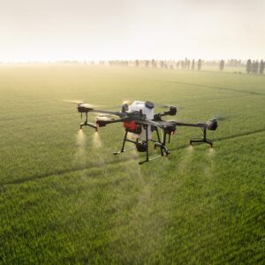
- Spraying – targeted spraying of inputs including fertilisers and pesticides.
- Crop damage assessment – rapid surveys post adverse events such as cyclones to measure and assess damage for internal as well as crop insurance purposes.
Approach
Technology is a tool, not a silver bullet. The most powerful approaches use a combination of available tools (satellites, drones, manual intervention). For instance, satellites can map large areas (hundreds of hectares) to identify regions of interest based on spectral signatures. Drones can survey those specific regions of interest to identify and classify problems such as pests, diseases, and water stress. Data from lab testing of samples taken from worst-afflicted zones can be used to further improve the AI algorithm that analysis drone and satellite data to allow for increasingly sophisticated analysis.