Vendor Information
- Store Name: Dronimagination Solutions Pvt Ltd
- Vendor: Dronimagination Solutions Pvt Ltd
-
Address:
7E 7th Floor
BCG Tower ,Kakkanad
Kochi 682030
Kerala, India - No ratings found yet!

₹800.00
Unlock the Power of Precision with Dronimagination’s Aerial Mapping and Survey Solutions!
At Dronimagination Pvt Ltd, we’re proud to introduce our cutting-edge aerial mapping and survey services powered by state-of-the-art drone technology. We understand the vital role accurate spatial data plays in decision-making for a wide range of industries, from agriculture and construction to urban planning and environmental management. Our specialized drone-based solutions offer a transformative way to acquire, analyze, and utilize high-resolution data for your projects.
Key Benefits:
High Precision Data: Our drones are equipped with advanced sensors and cameras that capture highly accurate, geo-referenced data, ensuring precise mapping and survey results.
Efficiency: Traditional ground-based surveying can be time-consuming and labor-intensive. With our drone services, we significantly reduce project timelines and costs while increasing efficiency.
Versatility: Whether you need topographic maps, 3D models, orthomosaics, or thermal imaging, our drones can be tailored to your specific project requirements.
Safety: Dronimagination’s drone-based services minimize the need for human presence in potentially hazardous environments, enhancing safety for both your team and the environment.
Environmental Impact: By utilizing drones, we reduce our carbon footprint compared to traditional survey methods, aligning with sustainable and eco-friendly practices.
Custom Solutions: We work closely with our clients to understand their unique needs and tailor our services to deliver actionable insights for informed decision-making.
Industries We Serve:
Agriculture: Optimize crop management, monitor soil health, and enhance yield predictions with our precision agriculture solutions.
Construction: Streamline site analysis, progress monitoring, and site planning to keep your construction projects on track.
Environmental Management: Monitor and protect fragile ecosystems with our environmental surveying services, tracking changes and promoting conservation efforts.
Urban Planning: Create detailed 3D models of urban areas to aid in infrastructure development, land-use planning, and smart city initiatives.
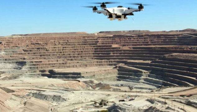
Mining and Exploration: Improve mineral exploration and extraction processes with accurate geological data and mine site analysis.
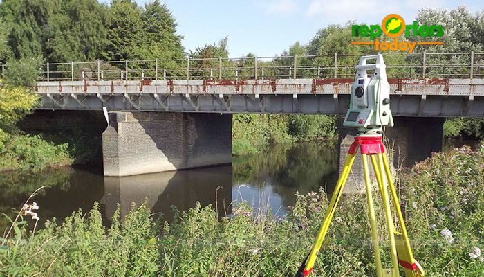
Infrastructure Inspection: Perform remote inspections of critical infrastructure such as bridges, power lines, and pipelines, ensuring safety and maintenance.
Emergency Response: Rapidly assess disaster-stricken areas for search and rescue operations or damage assessment.
With Dronimagination’s aerial mapping and survey solutions, you can harness the power of precise, actionable data to make informed decisions, enhance productivity, and drive the success of your projects. Join us in revolutionizing the way you gather information, and experience the future of aerial mapping and surveying today.
Contact to learn more about how our drone-based services can transform your industry and make your projects soar above the competition.


| Settings | Aerial Mapping remove | Geological Drone Survey remove | Mines Volumetric Drone Survey Service remove | Aerial Drone Mapping Survey Service remove | GIS Survey Service remove | Drone Mapping remove |
|---|---|---|---|---|---|---|
| Image | | 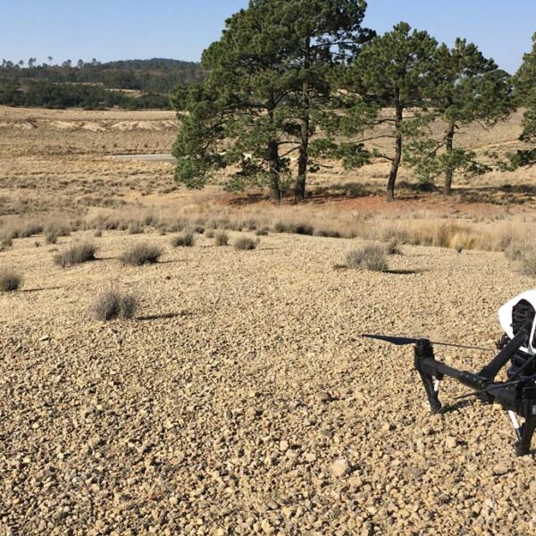 | 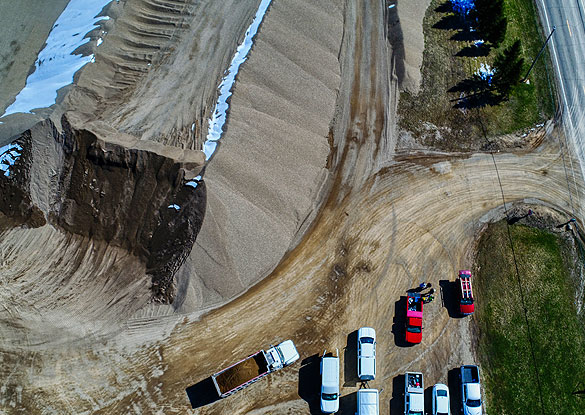 | 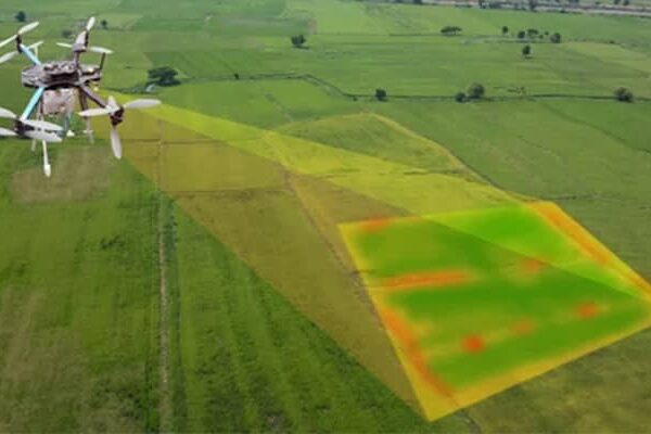 |  |  |
| SKU | ||||||
| Rating | ||||||
| Price | ₹800.00 | |||||
| Stock | ||||||
| Availability | ||||||
| Add to cart | ||||||
| Description | Unlock the Power of Precision with Dronimagination's Aerial Mapping and Survey Solutions! At Dronimagination Pvt Ltd, we're proud to introduce our cutting-edge aerial mapping and survey services powered by state-of-the-art drone technology. We understand the vital role accurate spatial data plays in decision-making for a wide range of industries, from agriculture and construction to urban planning and environmental management. Our specialized drone-based solutions offer a transformative way to acquire, analyze, and utilize high-resolution data for your projects. Key Benefits: High Precision Data: Our drones are equipped with advanced sensors and cameras that capture highly accurate, geo-referenced data, ensuring precise mapping and survey results. Efficiency: Traditional ground-based surveying can be time-consuming and labor-intensive. With our drone services, we significantly reduce project timelines and costs while increasing efficiency. Versatility: Whether you need topographic maps, 3D models, orthomosaics, or thermal imaging, our drones can be tailored to your specific project requirements. Safety: Dronimagination's drone-based services minimize the need for human presence in potentially hazardous environments, enhancing safety for both your team and the environment. Environmental Impact: By utilizing drones, we reduce our carbon footprint compared to traditional survey methods, aligning with sustainable and eco-friendly practices. Custom Solutions: We work closely with our clients to understand their unique needs and tailor our services to deliver actionable insights for informed decision-making. Industries We Serve: Agriculture: Optimize crop management, monitor soil health, and enhance yield predictions with our precision agriculture solutions. Construction: Streamline site analysis, progress monitoring, and site planning to keep your construction projects on track. Environmental Management: Monitor and protect fragile ecosystems with our environmental surveying services, tracking changes and promoting conservation efforts. Urban Planning: Create detailed 3D models of urban areas to aid in infrastructure development, land-use planning, and smart city initiatives. Mining and Exploration: Improve mineral exploration and extraction processes with accurate geological data and mine site analysis. Infrastructure Inspection: Perform remote inspections of critical infrastructure such as bridges, power lines, and pipelines, ensuring safety and maintenance. Emergency Response: Rapidly assess disaster-stricken areas for search and rescue operations or damage assessment. With Dronimagination's aerial mapping and survey solutions, you can harness the power of precise, actionable data to make informed decisions, enhance productivity, and drive the success of your projects. Join us in revolutionizing the way you gather information, and experience the future of aerial mapping and surveying today. Contact to learn more about how our drone-based services can transform your industry and make your projects soar above the competition. | Our organization is offering a large array of Geological Surveying Services to our valued clients. Rendered as per client need, these are used in various fields. In addition to this, the offered array of interior designing services is rendered using the latest technology and top-grade materials within a limited period. | Backed by our skilled professionals, we are involved in providing Volumetric Survey Service. | We strives to provide visible Aerial Drone Surveying/Mapping administrations all through India. With precise knowledge of the relevant field, we are instrumental in offering a comprehensive range of Aerial Mapping Service. We work for DJI Aerial Mapping Service as per the clients need. Also, offered services are famous for high flexibility, and quality assured. | Surveying India provides an effective drone mapping system to capture and process photogrammetric data for mining, construction, agriculture and infrastructure projects using the most advance drone in India. Our design software ensures a cost efficient and time saving solution for rapidly mapping and changes in mining, construction, agriculture and infrastructure applications. | We provides Drone/Unmanned Aerial Vehicle (UAV) services to both industry and government, covering a wide and varied range of tasks such as UAV inspection and survey, crisis management, radio tower, telecommunications links, industrial building, quarry, wind turbine, chimney, manufacturing works, bridge, rock face or other piece of infrastructure, and also deploy rapid reaction response teams to deal with emergencies and capable to reach places that are difficult, expensive, dangerous, ‘live’ or even impossible to approach by manned inspection teams. |
| Content | Services Include - 3D and 2D Mapping Usage/Application - AutoCAD Type Of Services - Visual Surveying Method - By Drone Service Type - Geological Drone Survey Service Location - PAN India Service Mode - Offline | Service Type - Mines Volumetric Drone Survey Service Location - PAN India Service Mode - Offline | Services Include - 3D and 2D Mapping Usage/Application - AutoCAD Type Of Services - Visual Surveying Method - By Drone Service Type - Aerial Drone Mapping Survey Service Location - PAN India Service Mode - Offline | Area / Size - Any Start Date / Month - Any Certification Need - yes Service Location - All Over India Service Mode - Any Service Duration - 1-12 Months | ||
| Weight | ||||||
| Dimensions | N/A | N/A | N/A | N/A | N/A | N/A |
| Additional information |