Vendor Information
- Store Name: Dronimagination Solutions Pvt Ltd
- Vendor: Dronimagination Solutions Pvt Ltd
-
Address:
7E 7th Floor
BCG Tower ,Kakkanad
Kochi 682030
Kerala, India - No ratings found yet!
")
₹1,000.00
Unlock Precision and Efficiency with Dronimagination’s Topographic Mapping Services!
At Dronimagination Pvt Ltd, we are dedicated to revolutionizing the world of topographic mapping. Our state-of-the-art drone services provide a powerful, cost-effective, and highly accurate solution for collecting crucial spatial data. Whether you’re involved in land development, infrastructure projects, environmental studies, or resource management, our specialized drone-based solutions will help you achieve the precision and efficiency you need.
Key Benefits:
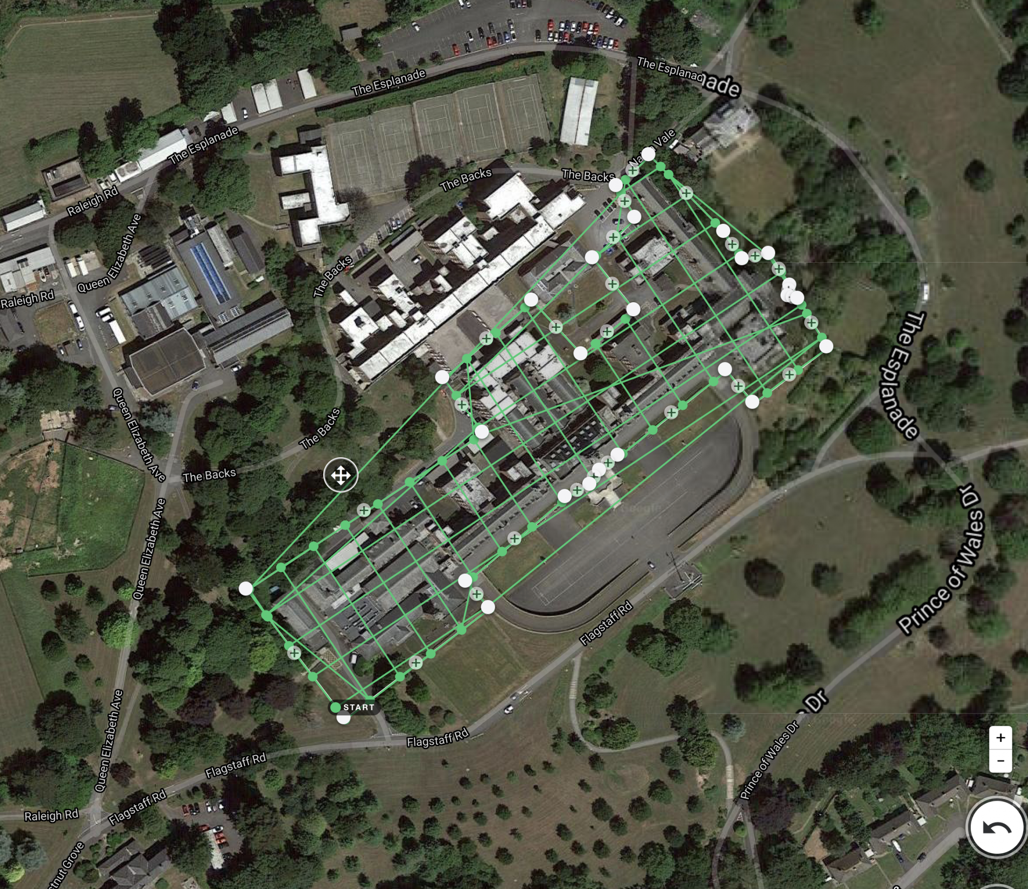
High Precision Data: Our drones are equipped with cutting-edge sensors and cameras that capture data with exceptional accuracy, enabling you to create detailed topographic maps.
Rapid Data Collection: Traditional ground-based surveys can be time-consuming and resource-intensive. With our drone services, we significantly reduce data collection time and costs, without sacrificing accuracy.
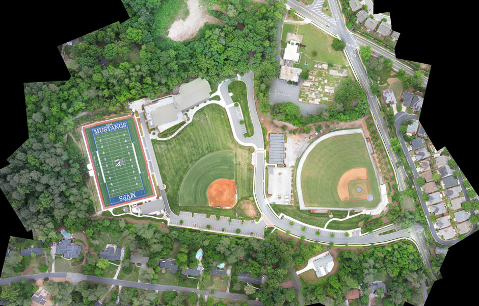
Customized Solutions: We tailor our drone services to meet your project’s unique needs, whether you require contour maps, digital elevation models (DEMs), or orthophotos.
Safety: By minimizing the need for human presence in challenging or hazardous environments, our drone-based services enhance safety for both your team and the environment.
Environmental Impact: Our drones are environmentally friendly, helping reduce the carbon footprint associated with traditional surveying methods.
Efficiency: Our advanced technology allows for rapid surveying, enabling you to complete projects ahead of schedule and within budget.
Applications:
Land Development: Streamline the site analysis and land planning process, ensuring that every aspect of your project is accurately mapped and accounted for.
Infrastructure Projects: Monitor progress, assess terrain, and plan infrastructure development with up-to-date topographic maps.
Environmental Studies: Support ecological research, wildlife habitat analysis, and environmental impact assessments with precise topographic data.
Resource Management: Optimize resource allocation and land use decisions by leveraging detailed, real-time topographic information.
Urban Planning: Create comprehensive 3D models of urban areas to enhance city planning and development.
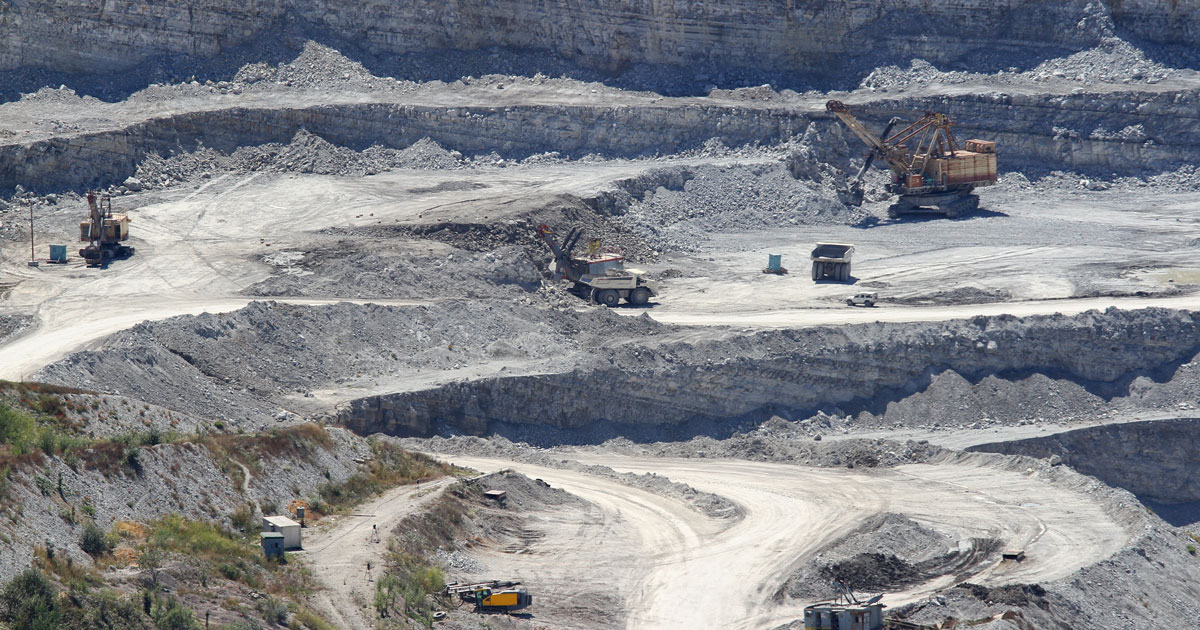
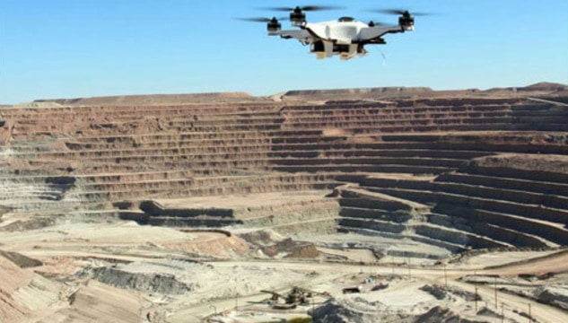
Mining and Exploration: Improve mine planning and resource management with precise geological data.
Dronimagination’s topographic mapping services offer a transformative way to acquire, analyze, and utilize high-resolution data for your projects. Our mission is to empower you with the tools you need to make informed decisions, reduce project timelines, and enhance productivity.
Contact to learn more about how our drone-based topographic mapping services can provide the competitive edge your projects deserve. Let’s take your topographic mapping to new heights!


| Settings | Topographic Survey remove | Drone UAV Survey remove | GIS Survey Service remove | Drone Mapping Survey Service remove | 3D Mining Drone Mapping Service remove | Aerial Survey Service remove |
|---|---|---|---|---|---|---|
| Image | |  |  | 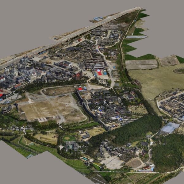 |  |  |
| SKU | ||||||
| Rating | ||||||
| Price | ₹1,000.00 | |||||
| Stock | ||||||
| Availability | ||||||
| Add to cart | ||||||
| Description | Unlock Precision and Efficiency with Dronimagination's Topographic Mapping Services! At Dronimagination Pvt Ltd, we are dedicated to revolutionizing the world of topographic mapping. Our state-of-the-art drone services provide a powerful, cost-effective, and highly accurate solution for collecting crucial spatial data. Whether you're involved in land development, infrastructure projects, environmental studies, or resource management, our specialized drone-based solutions will help you achieve the precision and efficiency you need. Key Benefits: High Precision Data: Our drones are equipped with cutting-edge sensors and cameras that capture data with exceptional accuracy, enabling you to create detailed topographic maps. Rapid Data Collection: Traditional ground-based surveys can be time-consuming and resource-intensive. With our drone services, we significantly reduce data collection time and costs, without sacrificing accuracy. Customized Solutions: We tailor our drone services to meet your project's unique needs, whether you require contour maps, digital elevation models (DEMs), or orthophotos. Safety: By minimizing the need for human presence in challenging or hazardous environments, our drone-based services enhance safety for both your team and the environment. Environmental Impact: Our drones are environmentally friendly, helping reduce the carbon footprint associated with traditional surveying methods. Efficiency: Our advanced technology allows for rapid surveying, enabling you to complete projects ahead of schedule and within budget. Applications: Land Development: Streamline the site analysis and land planning process, ensuring that every aspect of your project is accurately mapped and accounted for. Infrastructure Projects: Monitor progress, assess terrain, and plan infrastructure development with up-to-date topographic maps. Environmental Studies: Support ecological research, wildlife habitat analysis, and environmental impact assessments with precise topographic data. Resource Management: Optimize resource allocation and land use decisions by leveraging detailed, real-time topographic information. Urban Planning: Create comprehensive 3D models of urban areas to enhance city planning and development. Mining and Exploration: Improve mine planning and resource management with precise geological data. Dronimagination's topographic mapping services offer a transformative way to acquire, analyze, and utilize high-resolution data for your projects. Our mission is to empower you with the tools you need to make informed decisions, reduce project timelines, and enhance productivity. Contact to learn more about how our drone-based topographic mapping services can provide the competitive edge your projects deserve. Let's take your topographic mapping to new heights! | Our organization is offering an assorted range of UAV Survey. We are working dedicatedly to catering to the requirement of the client. Apart from this, our professionals make honest efforts to provide this survey service within the assured set of time. | Surveying India provides an effective drone mapping system to capture and process photogrammetric data for mining, construction, agriculture and infrastructure projects using the most advance drone in India. Our design software ensures a cost efficient and time saving solution for rapidly mapping and changes in mining, construction, agriculture and infrastructure applications. | We provides an effective drone mapping system to capture and process photogrammetric data for mining, construction, agriculture and infrastructure projects using the most advance drone currently available in Mumbai, India. Our design software ensures a cost efficient and time saving solution for rapidly mapping and changes in mining, construction, agriculture and infrastructure applications. | 3D Mining Drone Mapping Service. | Technological advances in both video camera equipment and RC (remote control) equipment allow Surveying India to capture cinema quality, full motion imagery. Using state or the art equipment we are able to go where zip lines, cables, camera booms are not, still retaining the integrity of the shot by capturing complicated and challenging footage. Conversely, to previous methods of filmmaking, our set-up and take-down time is quick and efficient. All our projects were met with a great satisfaction among our customers. |
| Content | Area / Size - Any Start Date / Month - Any Certification Need - yes Service Location - All Over India Service Mode - Any Service Duration - 1-12 Months | Site Location - All Over India Area / Size - Any Is It Mobile Access - Non Mobile Access | Usage/Application - AutoCAD and Global Mapper Surveying Method - By Drone Service Location - PAN India Service Mode - Offline | Aerial Survey Service in IndiaModes - All Site Location - All Over India Area / Size - Any Start Date / Month - Any Service Duration - 1-12 Months | ||
| Weight | ||||||
| Dimensions | N/A | N/A | N/A | N/A | N/A | N/A |
| Additional information |