Description
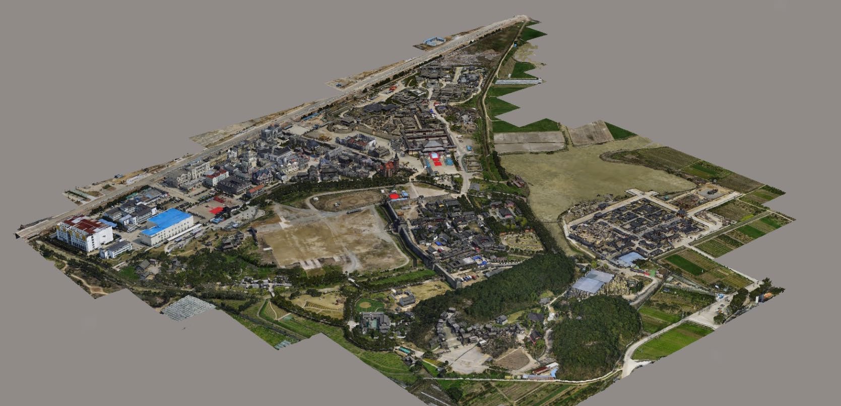
Aerial Survey Service in India
Modes – All
Site Location – All Over India
Area / Size – Any
Start Date / Month – Any
Service Duration – 1-12 Months

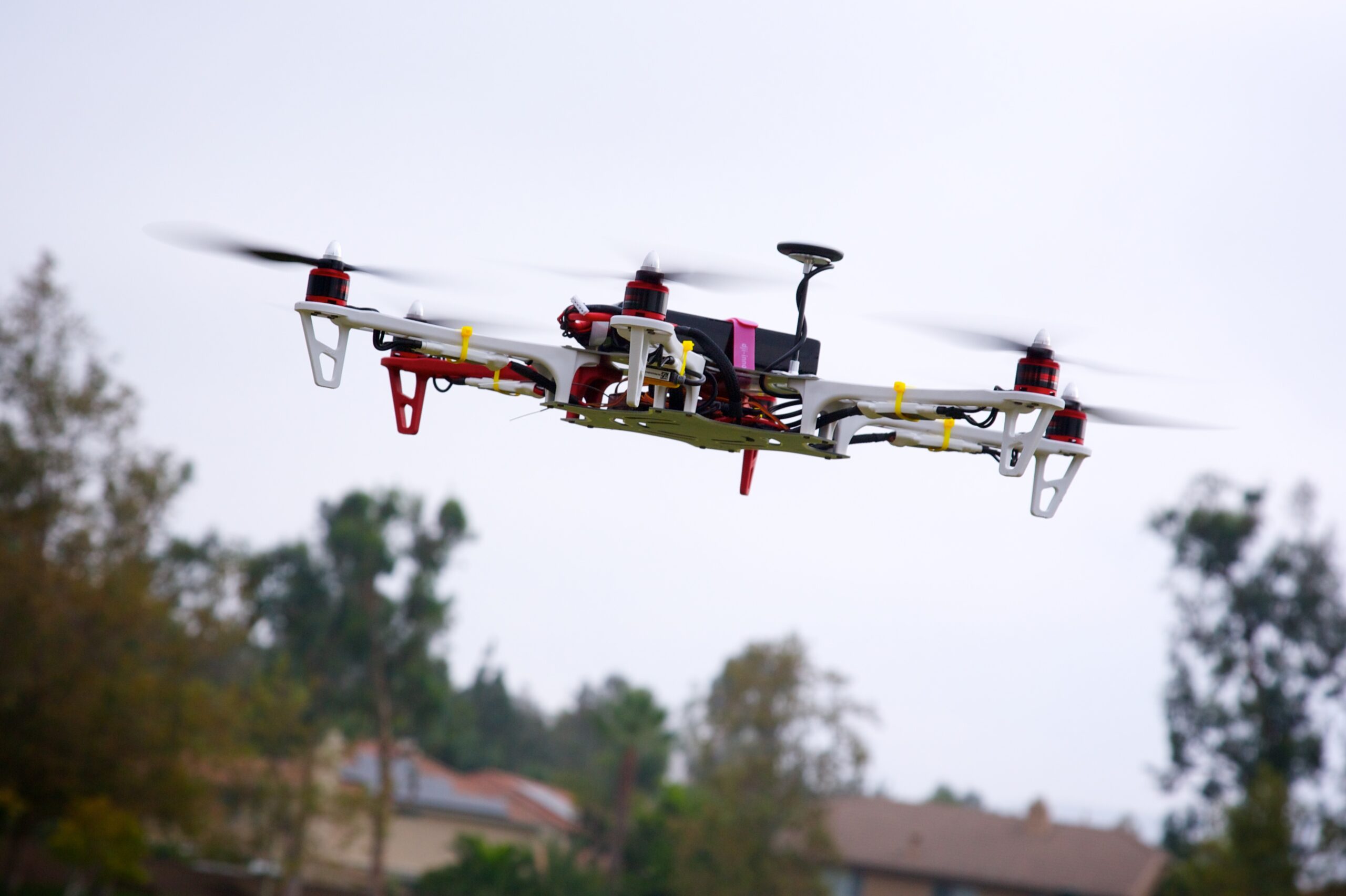
Technological advances in both video camera equipment and RC (remote control) equipment allow Surveying India to capture cinema quality, full motion imagery. Using state or the art equipment we are able to go where zip lines, cables, camera booms are not, still retaining the integrity of the shot by capturing complicated and challenging footage. Conversely, to previous methods of filmmaking, our set-up and take-down time is quick and efficient. All our projects were met with a great satisfaction among our customers.


Modes – All
Site Location – All Over India
Area / Size – Any
Start Date / Month – Any
Service Duration – 1-12 Months
| Settings | Aerial Survey Service remove | Railways and Roadways Planning and Progression Monitoring remove | DGPS Survey Services remove | Drone UAV Survey remove | 3D Mapping Drone Service remove | 3D Mining Drone Mapping Service remove |
|---|---|---|---|---|---|---|
| Image |  |  | 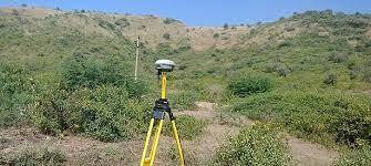 |  |  |  |
| SKU | ||||||
| Rating | ||||||
| Price | ||||||
| Stock | ||||||
| Availability | ||||||
| Add to cart | ||||||
| Description | Technological advances in both video camera equipment and RC (remote control) equipment allow Surveying India to capture cinema quality, full motion imagery. Using state or the art equipment we are able to go where zip lines, cables, camera booms are not, still retaining the integrity of the shot by capturing complicated and challenging footage. Conversely, to previous methods of filmmaking, our set-up and take-down time is quick and efficient. All our projects were met with a great satisfaction among our customers. |
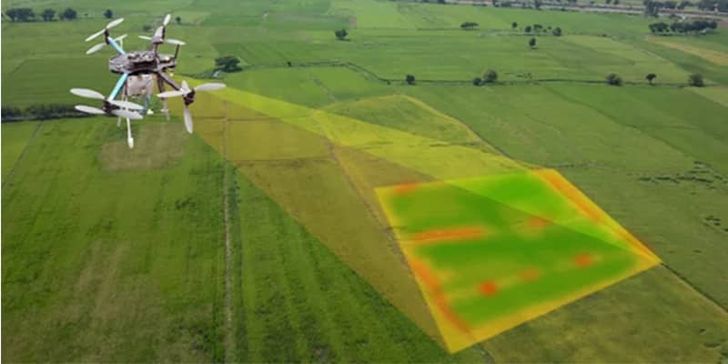
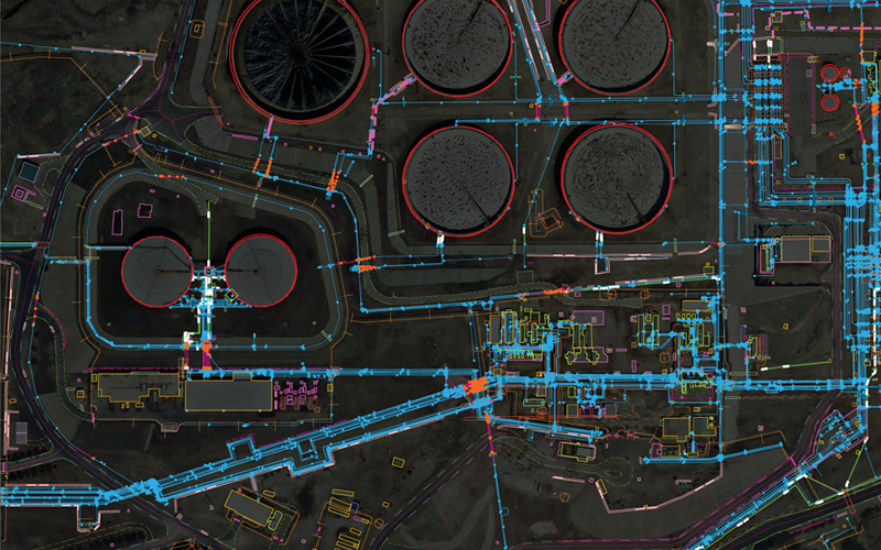
| Supported by highly accomplished crew of employees, we are rendering DGPS Survey Service. These provided services are delivered under the stern supervision of adroit personnel as per set industry principles. In addition to this, these provided services are attributed amid our client for reliability and cost effectiveness. | Our organization is offering an assorted range of UAV Survey. We are working dedicatedly to catering to the requirement of the client. Apart from this, our professionals make honest efforts to provide this survey service within the assured set of time. | We are one of the foremost firms of 3D Mapping Service. These services are enormously well-liked in the market for their nominal rates and consistency. | 3D Mining Drone Mapping Service. |
| Content | Aerial Survey Service in IndiaModes - All Site Location - All Over India Area / Size - Any Start Date / Month - Any Service Duration - 1-12 Months | Site Location - PAN India Mode Of Report - Excel Service Type - DGPS Survey Service Mode - Offline | Scope Of Survey - All Usage/Application - AutoCAD Type Of Services - Visual Surveying Method - By Drone Service Location - PAN India Service Mode - Offline Service Type - 3D Mapping Drone | Usage/Application - AutoCAD and Global Mapper Surveying Method - By Drone Service Location - PAN India Service Mode - Offline | ||
| Weight | ||||||
| Dimensions | N/A | N/A | N/A | N/A | N/A | N/A |
| Additional information |