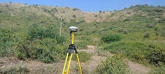
Description
Modes – Drone
Type – Automapper
Site Location – All Over India
Area / Size – Any
Start Date / Month – As per Client
Service Duration – 1-12 Months

Backed by years of experience in this domain, we have been able to offer the finest collection of Aerial Drone Survey. These services are admired for quality assurance and client focus approach. Apartfrom this, our team members remain in close contact with patrons to determine their requirements and render these survey services accordingly.


Modes – Drone
Type – Automapper
Site Location – All Over India
Area / Size – Any
Start Date / Month – As per Client
Service Duration – 1-12 Months
| Settings | Aerial Drone Survey Service remove | Drone Survey remove | GIS Survey Service remove | Aerial Drone Mapping Survey Service remove | Drone Mapping Survey Service remove | Drone UAV Survey remove |
|---|---|---|---|---|---|---|
| Image |  |  |  | 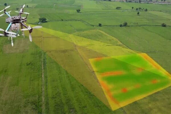 | 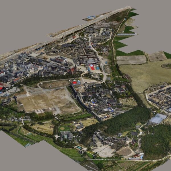 |  |
| SKU | ||||||
| Rating | ||||||
| Price | ||||||
| Stock | ||||||
| Availability | ||||||
| Add to cart | ||||||
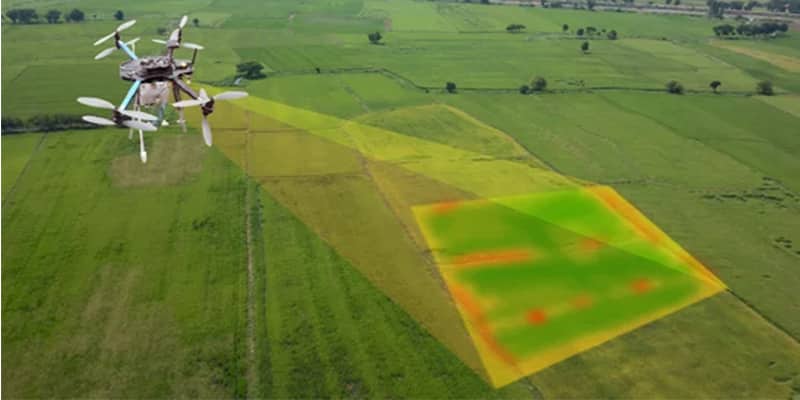
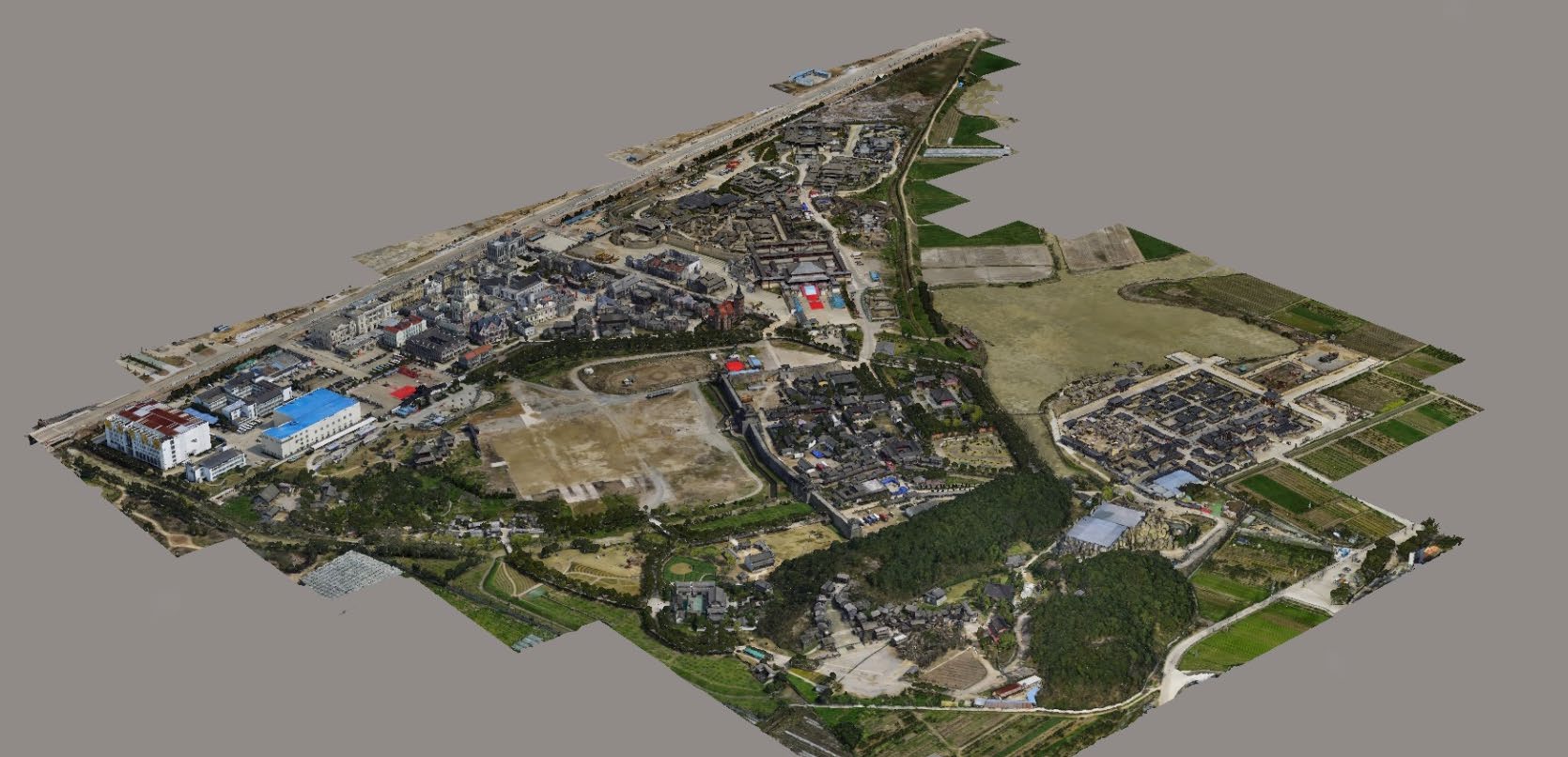
| Description | Backed by years of experience in this domain, we have been able to offer the finest collection of Aerial Drone Survey. These services are admired for quality assurance and client focus approach. Apartfrom this, our team members remain in close contact with patrons to determine their requirements and render these survey services accordingly. | We provides Drone/Unmanned Aerial Vehicle (UAV) services to both industry and government, covering a wide and varied range of tasks such as UAV inspection and survey, crisis management, radio tower, telecommunications links, industrial building, quarry, wind turbine, chimney, manufacturing works, bridge, rock face or other piece of infrastructure, and also deploy rapid reaction response teams to deal with emergencies and capable to reach places that are difficult, expensive, dangerous, ‘live’ or even impossible to approach by manned inspection teams. | Surveying India provides an effective drone mapping system to capture and process photogrammetric data for mining, construction, agriculture and infrastructure projects using the most advance drone in India. Our design software ensures a cost efficient and time saving solution for rapidly mapping and changes in mining, construction, agriculture and infrastructure applications. | We strives to provide visible Aerial Drone Surveying/Mapping administrations all through India. With precise knowledge of the relevant field, we are instrumental in offering a comprehensive range of Aerial Mapping Service. We work for DJI Aerial Mapping Service as per the clients need. Also, offered services are famous for high flexibility, and quality assured. | We provides an effective drone mapping system to capture and process photogrammetric data for mining, construction, agriculture and infrastructure projects using the most advance drone currently available in Mumbai, India. Our design software ensures a cost efficient and time saving solution for rapidly mapping and changes in mining, construction, agriculture and infrastructure applications. | Our organization is offering an assorted range of UAV Survey. We are working dedicatedly to catering to the requirement of the client. Apart from this, our professionals make honest efforts to provide this survey service within the assured set of time. |
| Content | Modes - Drone Type - Automapper Site Location - All Over India Area / Size - Any Start Date / Month - As per Client Service Duration - 1-12 Months | Area / Size - Any Start Date / Month - Any Certification Need - yes Service Location - All Over India Service Mode - Any Service Duration - 1-12 Months | Services Include - 3D and 2D Mapping Usage/Application - AutoCAD Type Of Services - Visual Surveying Method - By Drone Service Type - Aerial Drone Mapping Survey Service Location - PAN India Service Mode - Offline | Site Location - All Over India Area / Size - Any Is It Mobile Access - Non Mobile Access | ||
| Weight | ||||||
| Dimensions | N/A | N/A | N/A | N/A | N/A | N/A |
| Additional information |