Description
Measurement Type – UTM, DDMMSS, DEC.DEG.
Site Location – All Over India
Area / Size – Any
Start Date / Month – As per Client

Backed by massive industry proficiency, we are involved in presenting to our customers’ world class Engineering Topographical Surveying Service. So as to furnish the detailed demands of our patrons, we spend some time with our clients to understand their needs with a motive to accomplish supreme level of client satisfaction.


Measurement Type – UTM, DDMMSS, DEC.DEG.
Site Location – All Over India
Area / Size – Any
Start Date / Month – As per Client
| Settings | Topographical Survey Service remove | Aerial Survey Service remove | Drone UAV Survey remove | Survey Mapping Drone Service remove | Aerial Contours remove | Bridge Survey Service remove |
|---|---|---|---|---|---|---|
| Image | 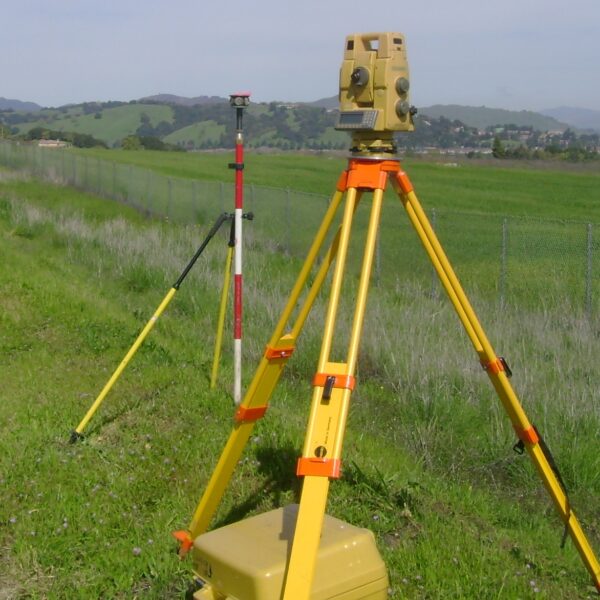 |  |  | 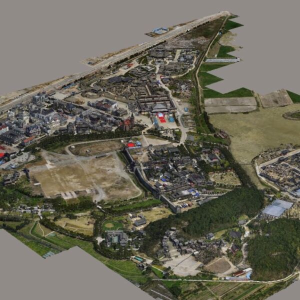 |  | 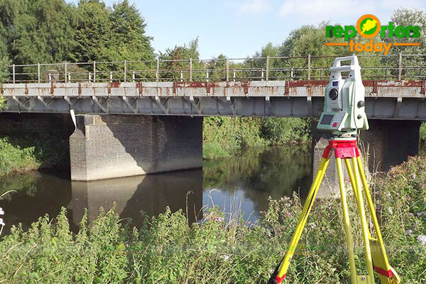 |
| SKU | ||||||
| Rating | ||||||
| Price | ||||||
| Stock | ||||||
| Availability | ||||||
| Add to cart | ||||||
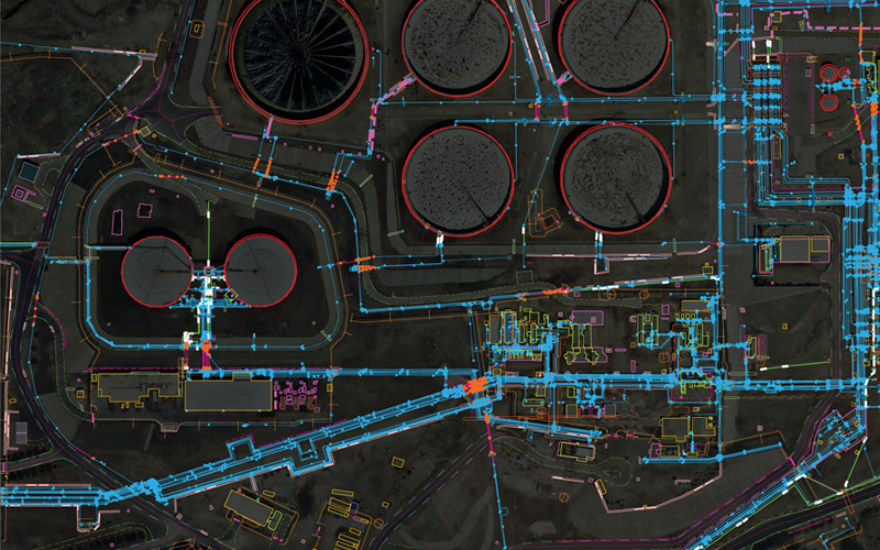
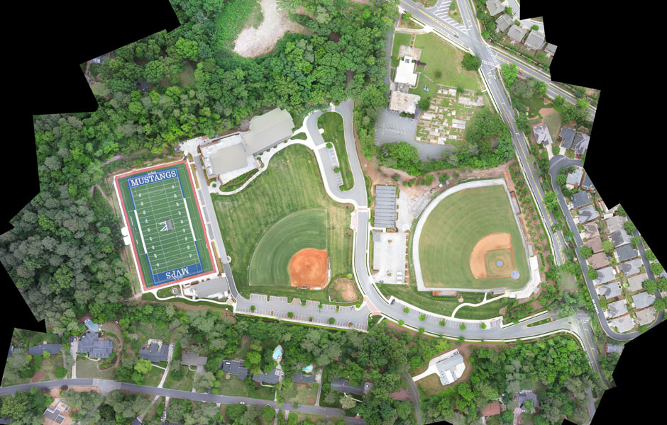
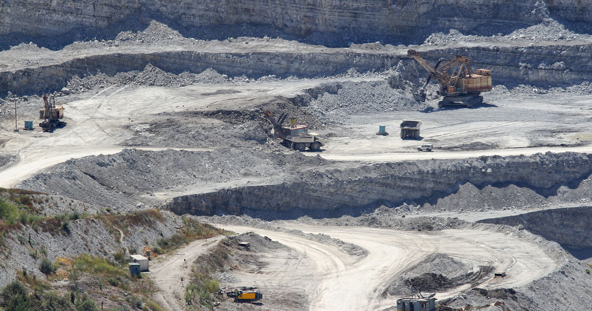
| Description | Backed by massive industry proficiency, we are involved in presenting to our customers’ world class Engineering Topographical Surveying Service. So as to furnish the detailed demands of our patrons, we spend some time with our clients to understand their needs with a motive to accomplish supreme level of client satisfaction. | Technological advances in both video camera equipment and RC (remote control) equipment allow Surveying India to capture cinema quality, full motion imagery. Using state or the art equipment we are able to go where zip lines, cables, camera booms are not, still retaining the integrity of the shot by capturing complicated and challenging footage. Conversely, to previous methods of filmmaking, our set-up and take-down time is quick and efficient. All our projects were met with a great satisfaction among our customers. | Our organization is offering an assorted range of UAV Survey. We are working dedicatedly to catering to the requirement of the client. Apart from this, our professionals make honest efforts to provide this survey service within the assured set of time. | Surveying India specializes in Aerial Contours. Contour lines are generated by connecting all the points of similar elevation together. These lines are drawn on a plan of a particular terrain to understand the nature of surface, identify cut fill volume, study water flow characteristics, estimate valley depth and steepness. Contour lines form a smooth curve of same elevation points. Contour lines are also called as isohypse, isoline, isopleth, or isarithm. | ||
| Content | Measurement Type - UTM, DDMMSS, DEC.DEG. Site Location - All Over India Area / Size - Any Start Date / Month - As per Client | Aerial Survey Service in IndiaModes - All Site Location - All Over India Area / Size - Any Start Date / Month - Any Service Duration - 1-12 Months | Service Type - Survey Mapping Service Location - PAN India Service Mode - Offline | Type - Site Service Mode - Offline | ||
| Weight | ||||||
| Dimensions | N/A | N/A | N/A | N/A | N/A | N/A |
| Additional information |