| Description | Topographic Land Surveying Drone Services. | Backed by our skilled professionals, we are involved in providing Volumetric Survey Service. |
- PROJECT CONSTRUCTION MONITORING
- RAILWAY ASSET MAPPING
- BRIDGE INSPECTION
- NH MONITORING
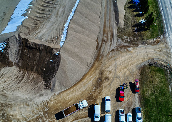
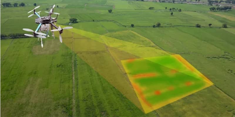
| 3D Mining Drone Mapping Service. | Our organization is offering a large array of Geological Surveying Services to our valued clients. Rendered as per client need, these are used in various fields. In addition to this, the offered array of interior designing services is rendered using the latest technology and top-grade materials within a limited period. | With the assistance of our enormously competent land diligent team members, we are involved in offering Drone Survey Service. These interior design work services can be offered as per client preferences. Apart from this, we are rendering these services with the help of the latest technology-based resources. |
| Content | Services Include - 3D and 2D Mapping
Usage/Application - AutoCAD and Global Mapper
Service Mode - Offline
Measurement Type - Acre
Surveying Method - By Drone
Service Type - Topographic Land Surveying Drone
Service Location - PAN India | Service Type - Mines Volumetric Drone Survey
Service Location - PAN India
Service Mode - Offline | | Usage/Application - AutoCAD and Global Mapper
Surveying Method - By Drone
Service Location - PAN India
Service Mode - Offline | Services Include - 3D and 2D Mapping
Usage/Application - AutoCAD
Type Of Services - Visual
Surveying Method - By Drone
Service Type - Geological Drone Survey
Service Location - PAN India
Service Mode - Offline | Measurement Type - Acre
Service Mode - Offline
Surveying Method - By Drone
Type Of Services - Visual
Usage/Application - AutoCAD
Services Include - 3D and 2D Mapping
Service Type - Drone Topographical Survey
Service Location - PAN India |