Description
Survey Type – GIS Mapping Survey
Scope Of Survey – All
Services Include – 3D and 2D Mapping
Usage/Application – AutoCAD
Type Of Services – Visual
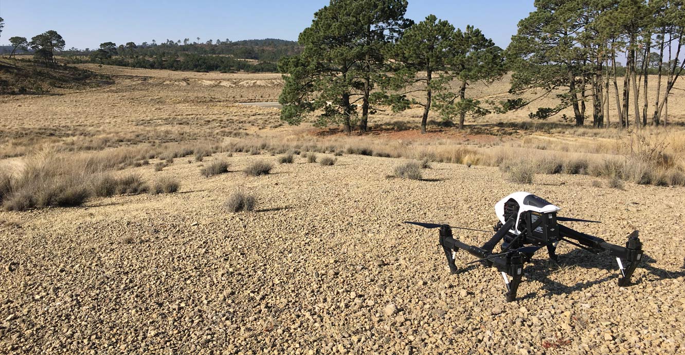
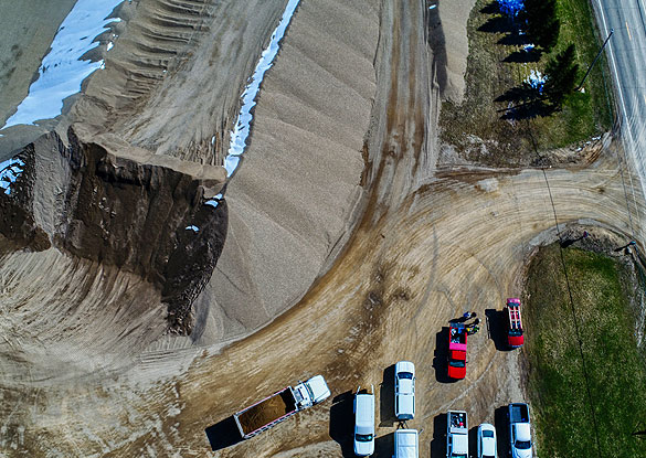
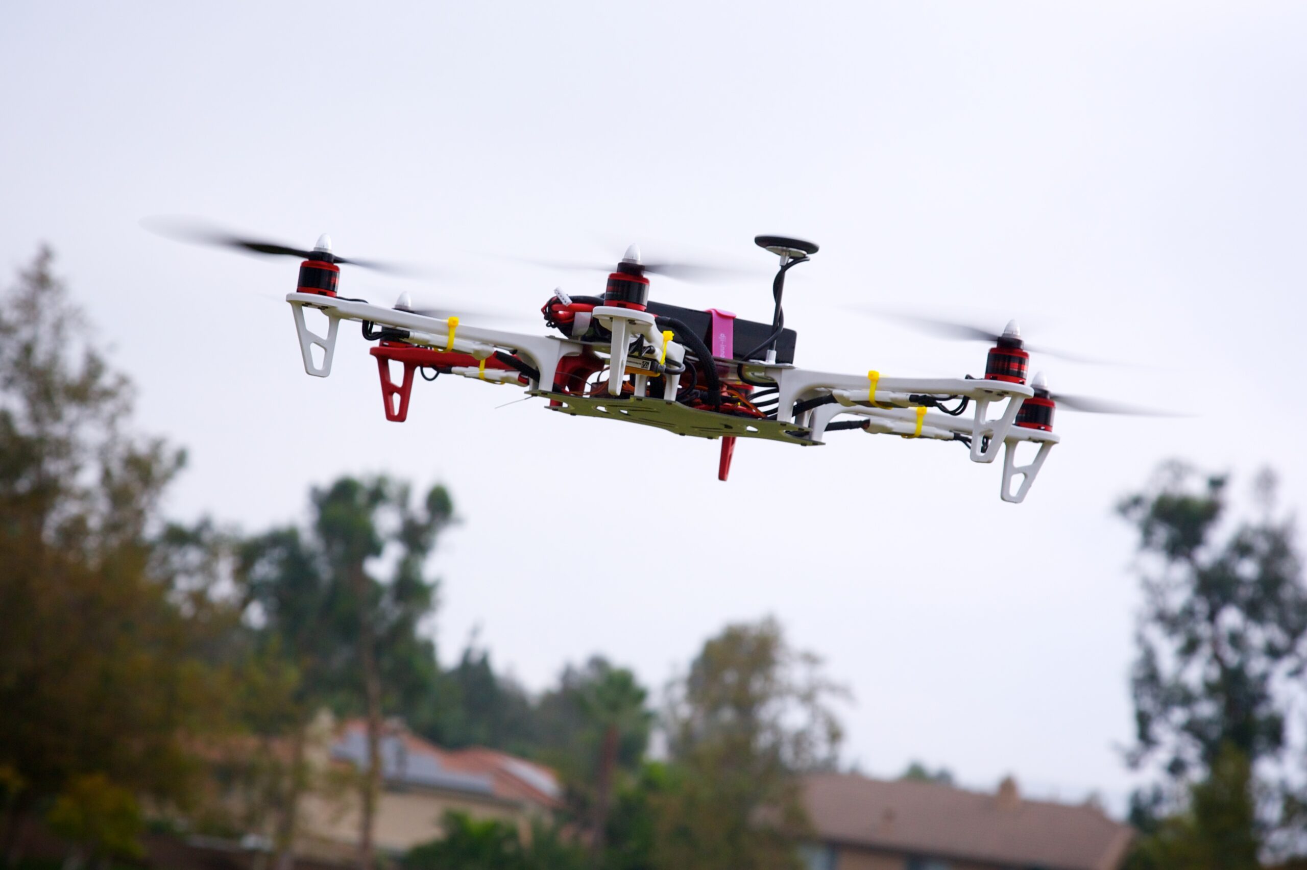
Surveying Method – By Drone
Service Mode – Offline

In order to grab the higher position of the industry, we offer a wide range of GIS Mapping Service. The provided service is rendered using advanced technology. Owing to its flawless execution, and perfect work, this mapping service is valued by our honored clients.


Survey Type – GIS Mapping Survey
Scope Of Survey – All
Services Include – 3D and 2D Mapping
Usage/Application – AutoCAD
Type Of Services – Visual
Surveying Method – By Drone
Service Mode – Offline
| Settings | GIS Mapping Drone Survey Service remove | Drone Survey remove | Drone Topographical Survey Service remove | GIS Survey Service remove | Aerial Survey Service remove | Land Survey remove |
|---|---|---|---|---|---|---|
| Image | 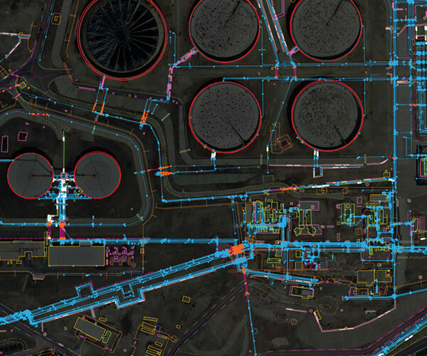 |  | 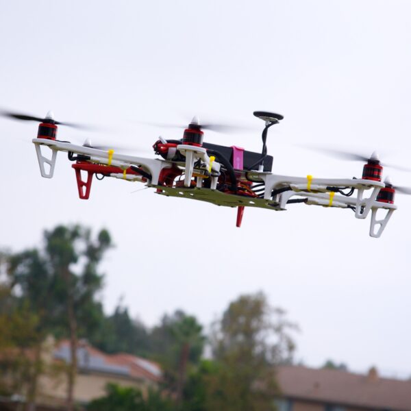 |  |  | 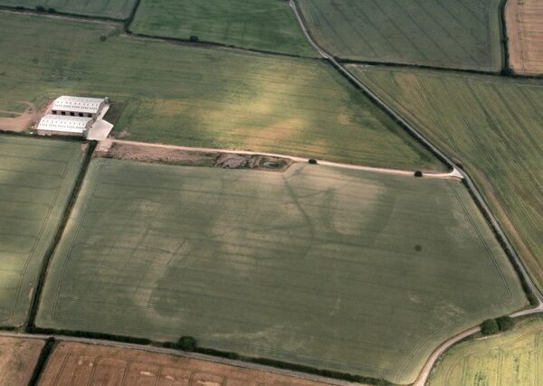 |
| SKU | ||||||
| Rating | ||||||
| Price | ||||||
| Stock | ||||||
| Availability | ||||||
| Add to cart | ||||||
| Description | In order to grab the higher position of the industry, we offer a wide range of GIS Mapping Service. The provided service is rendered using advanced technology. Owing to its flawless execution, and perfect work, this mapping service is valued by our honored clients. | We provides Drone/Unmanned Aerial Vehicle (UAV) services to both industry and government, covering a wide and varied range of tasks such as UAV inspection and survey, crisis management, radio tower, telecommunications links, industrial building, quarry, wind turbine, chimney, manufacturing works, bridge, rock face or other piece of infrastructure, and also deploy rapid reaction response teams to deal with emergencies and capable to reach places that are difficult, expensive, dangerous, ‘live’ or even impossible to approach by manned inspection teams. | With the assistance of our enormously competent land diligent team members, we are involved in offering Drone Survey Service. These interior design work services can be offered as per client preferences. Apart from this, we are rendering these services with the help of the latest technology-based resources. | Surveying India provides an effective drone mapping system to capture and process photogrammetric data for mining, construction, agriculture and infrastructure projects using the most advance drone in India. Our design software ensures a cost efficient and time saving solution for rapidly mapping and changes in mining, construction, agriculture and infrastructure applications. | Technological advances in both video camera equipment and RC (remote control) equipment allow Surveying India to capture cinema quality, full motion imagery. Using state or the art equipment we are able to go where zip lines, cables, camera booms are not, still retaining the integrity of the shot by capturing complicated and challenging footage. Conversely, to previous methods of filmmaking, our set-up and take-down time is quick and efficient. All our projects were met with a great satisfaction among our customers. |
|
| Content | Survey Type - GIS Mapping Survey Scope Of Survey - All Services Include - 3D and 2D Mapping Usage/Application - AutoCAD Type Of Services - Visual Surveying Method - By Drone Service Mode - Offline | Measurement Type - Acre Service Mode - Offline Surveying Method - By Drone Type Of Services - Visual Usage/Application - AutoCAD Services Include - 3D and 2D Mapping Service Type - Drone Topographical Survey Service Location - PAN India | Area / Size - Any Start Date / Month - Any Certification Need - yes Service Location - All Over India Service Mode - Any Service Duration - 1-12 Months | Aerial Survey Service in IndiaModes - All Site Location - All Over India Area / Size - Any Start Date / Month - Any Service Duration - 1-12 Months | ||
| Weight | ||||||
| Dimensions | N/A | N/A | N/A | N/A | N/A | N/A |
| Additional information |