Description
Service Type – Survey Mapping
Service Location – PAN India
Service Mode – Offline


Service Type – Survey Mapping
Service Location – PAN India
Service Mode – Offline
| Settings | Survey Mapping Drone Service remove | GIS Mapping Drone Survey Service remove | Aerial Mapping Service remove | 3D Mining Drone Mapping Service remove | GIS Survey Service remove | NHAI Road Survey remove |
|---|---|---|---|---|---|---|
| Image | 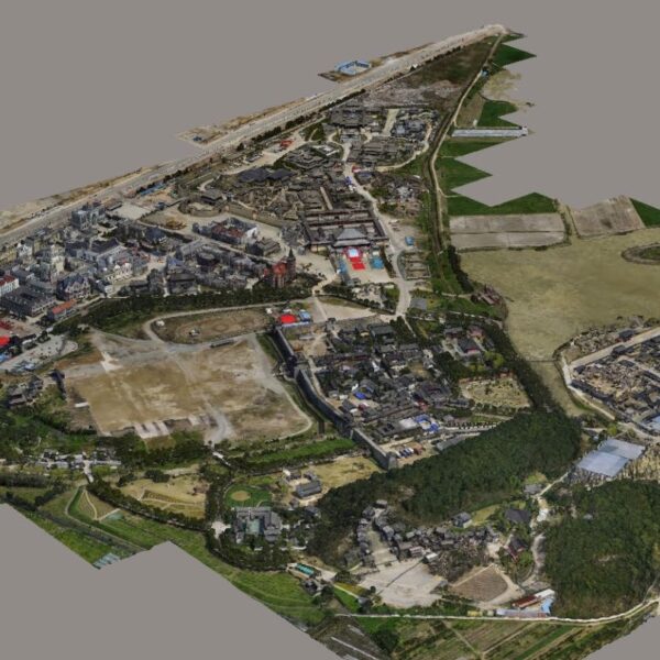 | 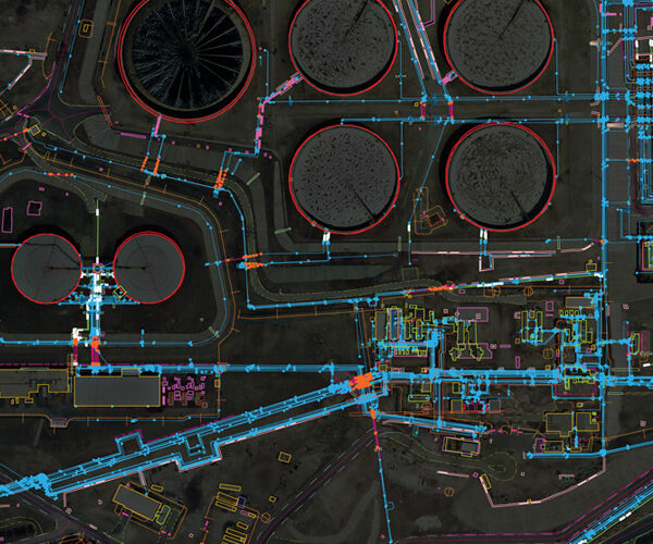 |  |  |  |  |
| SKU | ||||||
| Rating | ||||||
| Price | ||||||
| Stock | ||||||
| Availability | ||||||
| Add to cart | ||||||
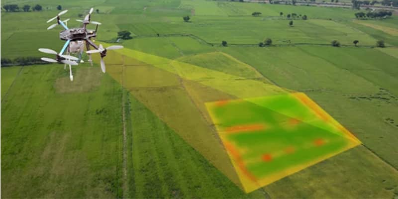
| Description | In order to grab the higher position of the industry, we offer a wide range of GIS Mapping Service. The provided service is rendered using advanced technology. Owing to its flawless execution, and perfect work, this mapping service is valued by our honored clients. | Through regular improvement, we are offering an exclusive collection of Aerial Mapping Service. Our highly skilledprofessionals render this offered mapping service on well-defined parameters. Offered array of mapping services is rendered using best grade inputs.
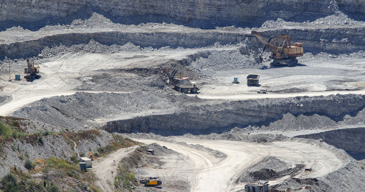
| 3D Mining Drone Mapping Service. | Surveying India provides an effective drone mapping system to capture and process photogrammetric data for mining, construction, agriculture and infrastructure projects using the most advance drone in India. Our design software ensures a cost efficient and time saving solution for rapidly mapping and changes in mining, construction, agriculture and infrastructure applications. | In India, the National Highways Development Project is being carried out to upgrade, rehabilitate and widen major highways to a higher standard. "National Highways" account for only about 2% of the total length of roads, but carry about 40% of the total traffic across the length and breadth of the country. These projects are managed by the National Highways Authority of India (NHAI) under the Ministry of Road, Transport and Highways. We also provide NHAI Road Survey | |
| Content | Service Type - Survey Mapping Service Location - PAN India Service Mode - Offline | Survey Type - GIS Mapping Survey Scope Of Survey - All Services Include - 3D and 2D Mapping Usage/Application - AutoCAD Type Of Services - Visual Surveying Method - By Drone Service Mode - Offline | Site Location - All Over India Area / Size - Any Start Date / Month - Any Is It Mobile Access - Mobile Access | Usage/Application - AutoCAD and Global Mapper Surveying Method - By Drone Service Location - PAN India Service Mode - Offline | Area / Size - Any Start Date / Month - Any Certification Need - yes Service Location - All Over India Service Mode - Any Service Duration - 1-12 Months | Site Location - Pan India Surveying Location - Pan Location Service Mode - Offline Mode Of Report - Hard copy Scope Of Survey - All existing features |
| Weight | ||||||
| Dimensions | N/A | N/A | N/A | N/A | N/A | N/A |
| Additional information |