Description
Service Mode – On Site
Service Location – PAN India
Service Type – Lidar Survey Services
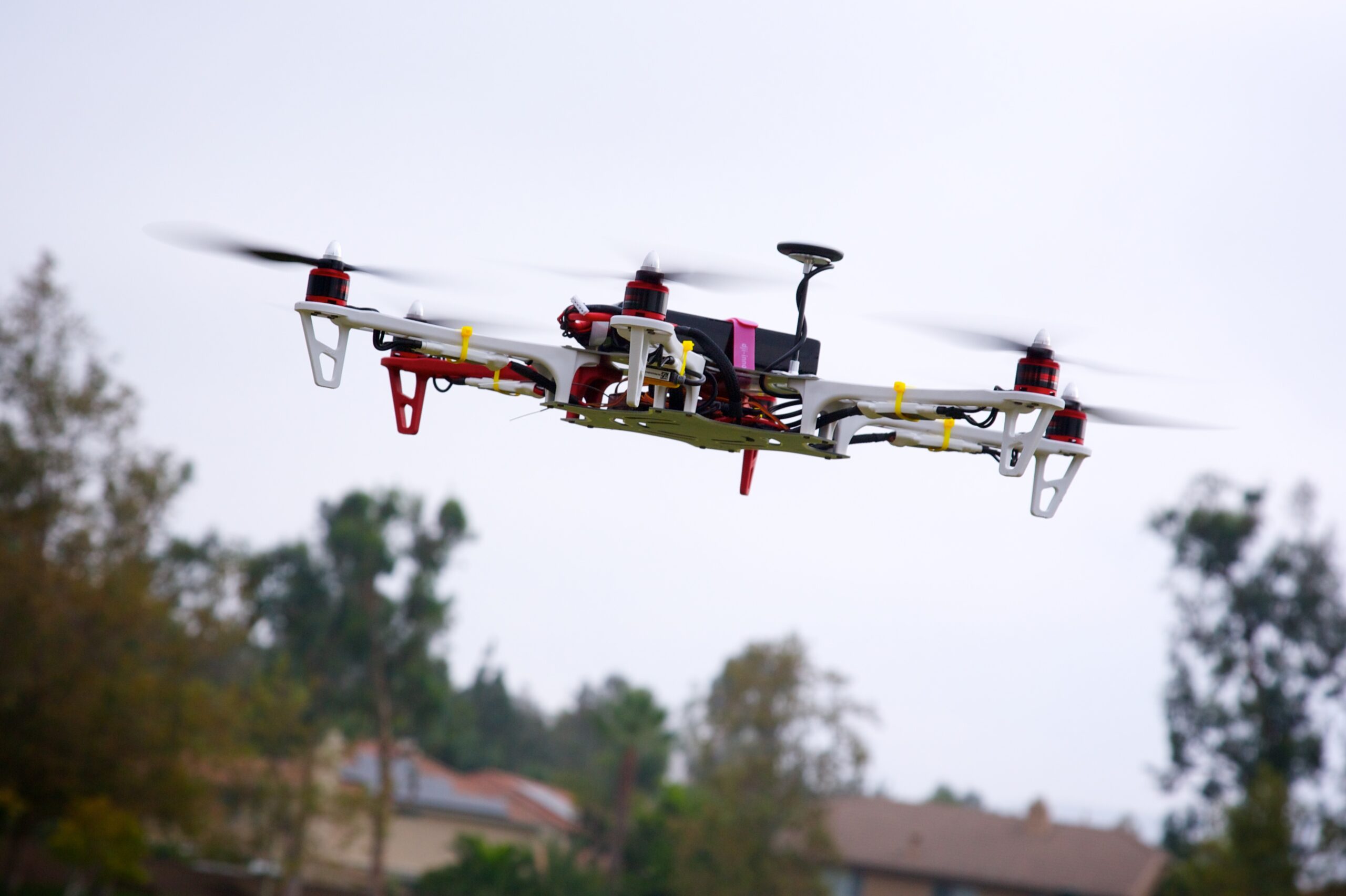
Type of Technology – Using By Drone

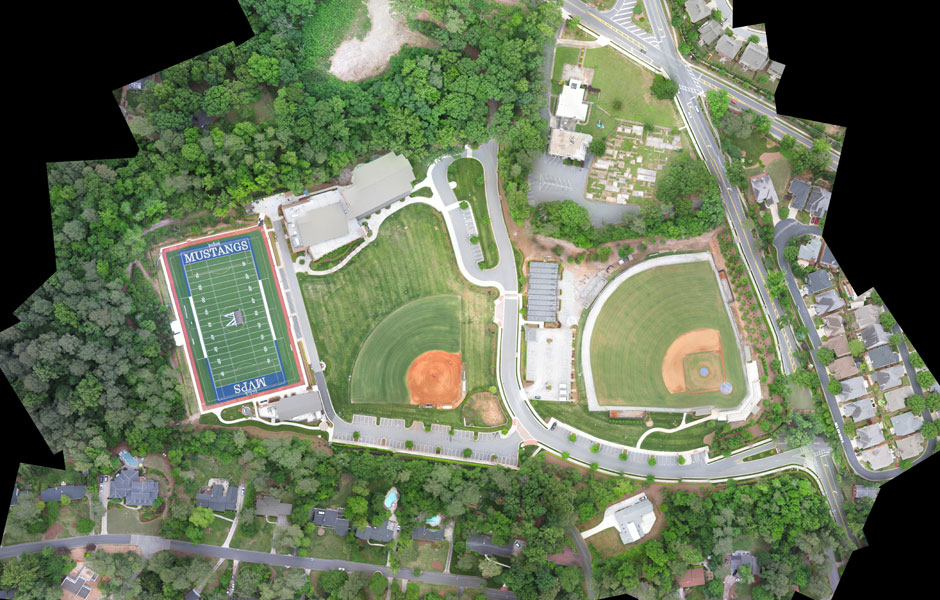
LIDAR, or LiDAR; sometimes LADAR) is a method for determining ranges (variable distance) by targeting an object or a surface with a laser and measuring the time for the reflected light to return to the receiver. It can also be used to make digital 3-D representations of areas on the earth’s surface and ocean bottom by varying the wavelength of light. It has terrestrial, airborne, and mobile applications.
Lidar is an acronym of “light detection and ranging” or “laser imaging, detection, and ranging”. It is sometimes called 3-D laser scanning, a special combination of 3-D scanning and laser scanning.
Lidar is commonly used to make high-resolution maps, with applications in surveying, geodesy, geomatics, archaeology, geography, geology, geomorphology, seismology, forestry, atmospheric physics, laser guidance, airborne laser swath mapping (ALSM), and laser altimetry. It is also used in control and navigation for some autonomous cars and for the helicopter Ingenuity on its record-setting flights over the terrain of Mars.


Service Mode – On Site
Service Location – PAN India
Service Type – Lidar Survey Services
Type of Technology – Using By Drone
| Settings | Lidar Survey Services remove | Aerial Contours remove | DGPS Survey Services remove | Railways and Roadways Planning and Progression Monitoring remove | Drone Topographical Survey Service remove | GIS Mapping Drone Survey Service remove |
|---|---|---|---|---|---|---|
| Image | 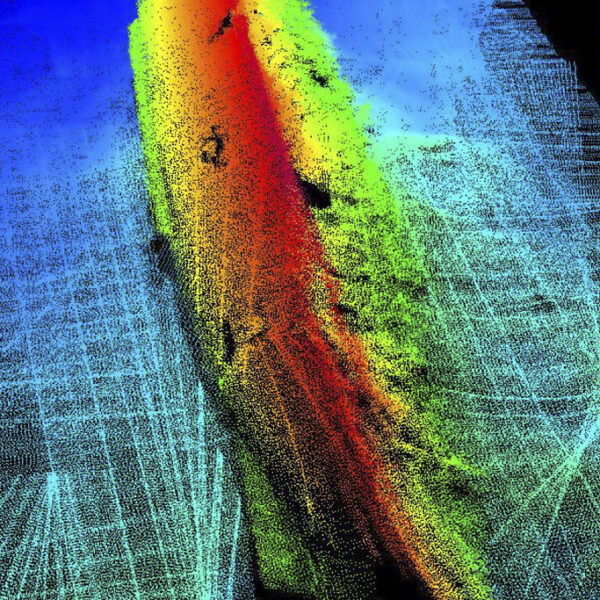 |  | 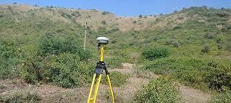 |  | 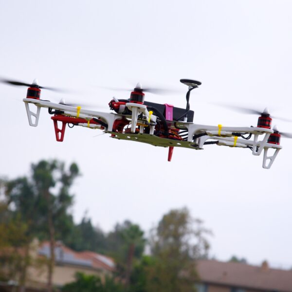 | 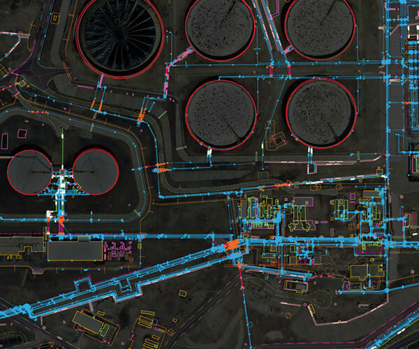 |
| SKU | ||||||
| Rating | ||||||
| Price | ||||||
| Stock | ||||||
| Availability | ||||||
| Add to cart | ||||||
| Description | LIDAR, or LiDAR; sometimes LADAR) is a method for determining ranges (variable distance) by targeting an object or a surface with a laser and measuring the time for the reflected light to return to the receiver. It can also be used to make digital 3-D representations of areas on the earth's surface and ocean bottom by varying the wavelength of light. It has terrestrial, airborne, and mobile applications. Lidar is an acronym of "light detection and ranging" or "laser imaging, detection, and ranging". It is sometimes called 3-D laser scanning, a special combination of 3-D scanning and laser scanning. Lidar is commonly used to make high-resolution maps, with applications in surveying, geodesy, geomatics, archaeology, geography, geology, geomorphology, seismology, forestry, atmospheric physics, laser guidance, airborne laser swath mapping (ALSM), and laser altimetry. It is also used in control and navigation for some autonomous cars and for the helicopter Ingenuity on its record-setting flights over the terrain of Mars. | Surveying India specializes in Aerial Contours. Contour lines are generated by connecting all the points of similar elevation together. These lines are drawn on a plan of a particular terrain to understand the nature of surface, identify cut fill volume, study water flow characteristics, estimate valley depth and steepness. Contour lines form a smooth curve of same elevation points. Contour lines are also called as isohypse, isoline, isopleth, or isarithm. | Supported by highly accomplished crew of employees, we are rendering DGPS Survey Service. These provided services are delivered under the stern supervision of adroit personnel as per set industry principles. In addition to this, these provided services are attributed amid our client for reliability and cost effectiveness. |
| With the assistance of our enormously competent land diligent team members, we are involved in offering Drone Survey Service. These interior design work services can be offered as per client preferences. Apart from this, we are rendering these services with the help of the latest technology-based resources. | In order to grab the higher position of the industry, we offer a wide range of GIS Mapping Service. The provided service is rendered using advanced technology. Owing to its flawless execution, and perfect work, this mapping service is valued by our honored clients. |
| Content | Service Mode - On Site Service Location - PAN India Service Type - Lidar Survey Services Type of Technology - Using By Drone | Type - Site Service Mode - Offline | Site Location - PAN India Mode Of Report - Excel Service Type - DGPS Survey Service Mode - Offline | Measurement Type - Acre Service Mode - Offline Surveying Method - By Drone Type Of Services - Visual Usage/Application - AutoCAD Services Include - 3D and 2D Mapping Service Type - Drone Topographical Survey Service Location - PAN India | Survey Type - GIS Mapping Survey Scope Of Survey - All Services Include - 3D and 2D Mapping Usage/Application - AutoCAD Type Of Services - Visual Surveying Method - By Drone Service Mode - Offline | |
| Weight | ||||||
| Dimensions | N/A | N/A | N/A | N/A | N/A | N/A |
| Additional information |