Description
Service Location – PAN India
Service Mode – Onsite
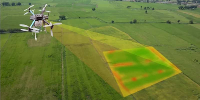
Service Type – Photogrammetry Survey
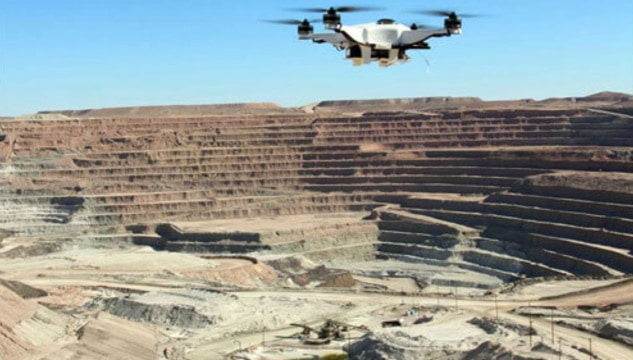
Type of Technology – Using By Drone

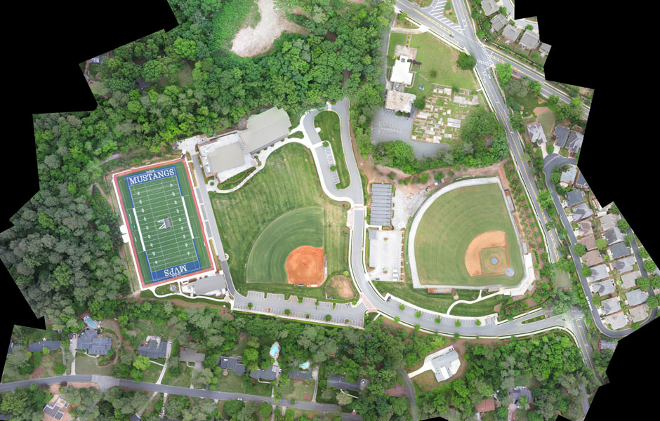
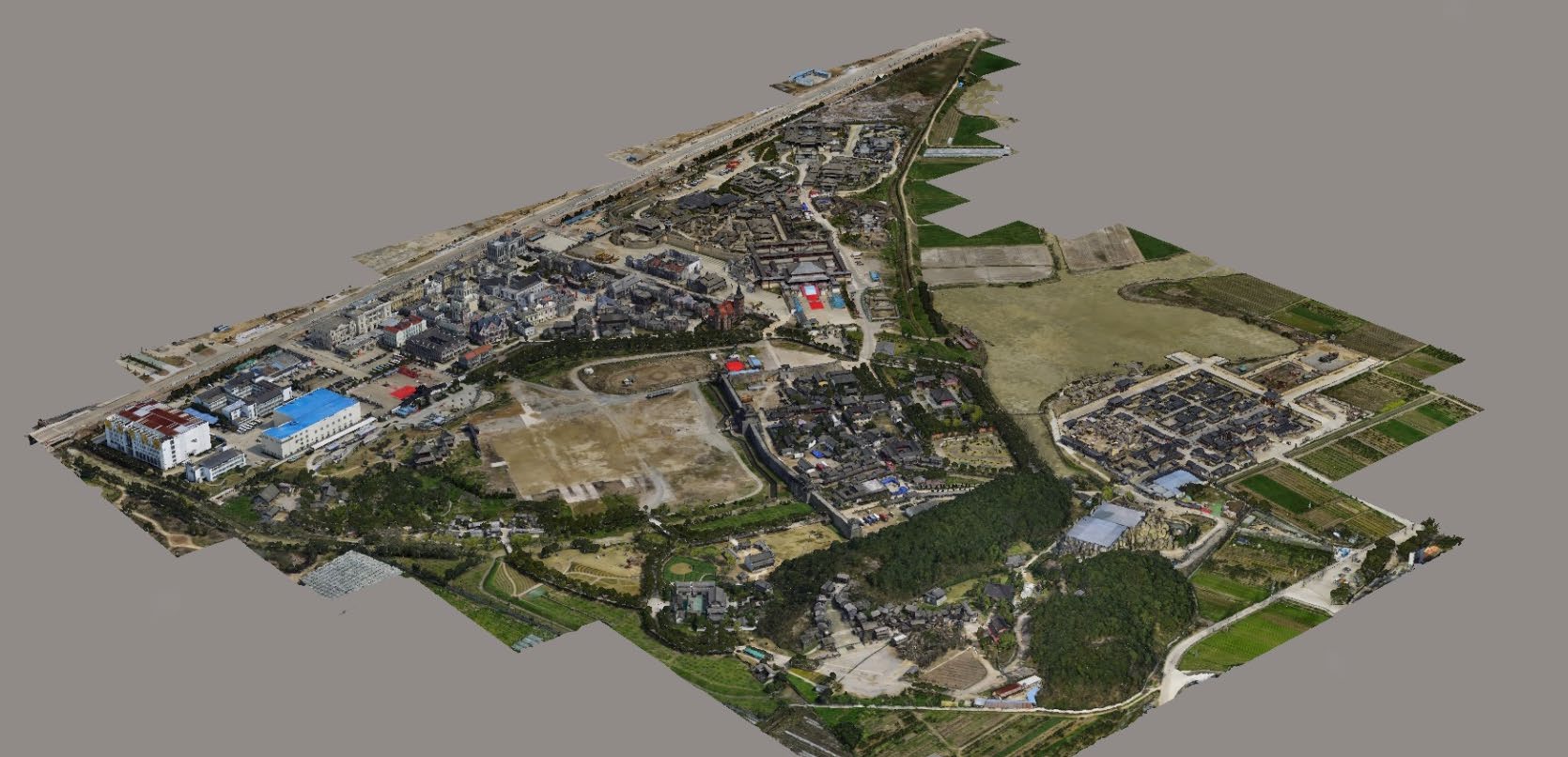
In modern mapping, a topographic map or topographic sheet is a type of map characterized by large-scale detail and quantitative representation of relief features, usually using contour lines (connecting points of equal elevation), but historically using a variety of methods. Traditional definitions require a topographic map to show both natural and artificial features. A topographic survey is typically based upon a systematic observation and published as a map series, made up of two or more map sheets that combine to form the whole map. A topographic map series uses a common specification that includes the range of cartographic symbols employed, as well as a standard geodetic framework that defines the map projection, coordinate system, ellipsoid and geodetic datum. Official topographic maps also adopt a national grid referencing system.
Natural Resources Canada provides this description of topographic maps:
These maps depict in detail ground relief (landforms and terrain), drainage (lakes and rivers), forest cover, administrative areas, populated areas, transportation routes and facilities (including roads and railways), and other man-made features.
Other authors define topographic maps by contrasting them with another type of map; they are distinguished from smaller-scale “chorographic maps” that cover large regions, “planimetric maps” that do not show elevations, and “thematic maps” that focus on specific topics.
However, in the vernacular and day to day world, the representation of relief (contours) is popularly held to define the genre, such that even small-scale maps showing relief are commonly (and erroneously, in the technical sense) called “topographic”.
The study or discipline of topography is a much broader field of study, which takes into account all natural and man-made features of terrain. Maps were among the first artifacts to record observations about topography.


Service Location – PAN India
Service Mode – Onsite
Service Type – Photogrammetry Survey
Type of Technology – Using By Drone
| Settings | Aerial Topographic Survey remove | Mines Volumetric Drone Survey Service remove | Railways and Roadways Planning and Progression Monitoring remove | Drone Mine Topographic Survey Services remove | Survey Mapping Drone Service remove | Acre 3d And 2d Mapping remove |
|---|---|---|---|---|---|---|
| Image |  | 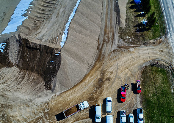 |  | 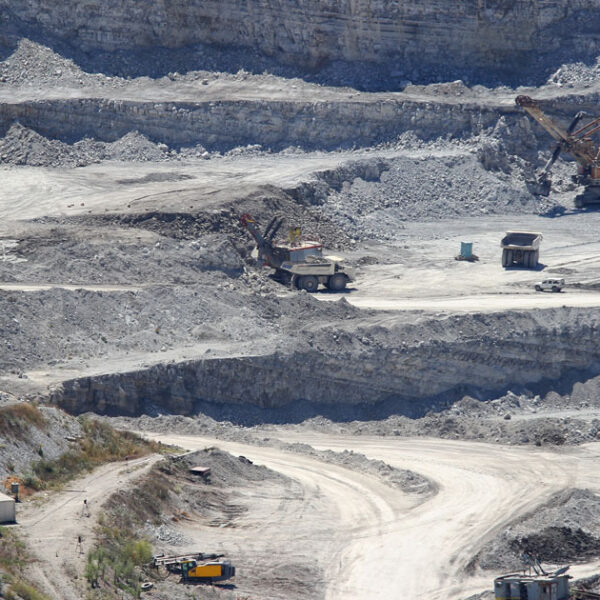 | 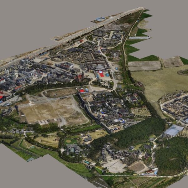 | 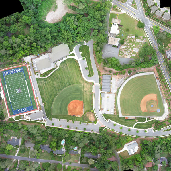 |
| SKU | ||||||
| Rating | ||||||
| Price | ||||||
| Stock | ||||||
| Availability | ||||||
| Add to cart | ||||||
| Description | In modern mapping, a topographic map or topographic sheet is a type of map characterized by large-scale detail and quantitative representation of relief features, usually using contour lines (connecting points of equal elevation), but historically using a variety of methods. Traditional definitions require a topographic map to show both natural and artificial features. A topographic survey is typically based upon a systematic observation and published as a map series, made up of two or more map sheets that combine to form the whole map. A topographic map series uses a common specification that includes the range of cartographic symbols employed, as well as a standard geodetic framework that defines the map projection, coordinate system, ellipsoid and geodetic datum. Official topographic maps also adopt a national grid referencing system. Natural Resources Canada provides this description of topographic maps: These maps depict in detail ground relief (landforms and terrain), drainage (lakes and rivers), forest cover, administrative areas, populated areas, transportation routes and facilities (including roads and railways), and other man-made features. Other authors define topographic maps by contrasting them with another type of map; they are distinguished from smaller-scale "chorographic maps" that cover large regions, "planimetric maps" that do not show elevations, and "thematic maps" that focus on specific topics. However, in the vernacular and day to day world, the representation of relief (contours) is popularly held to define the genre, such that even small-scale maps showing relief are commonly (and erroneously, in the technical sense) called "topographic". The study or discipline of topography is a much broader field of study, which takes into account all natural and man-made features of terrain. Maps were among the first artifacts to record observations about topography. | Backed by our skilled professionals, we are involved in providing Volumetric Survey Service. |
| We at Pixroot Technologies Private Limited specialized in providing high-quality Drone Survey Services. We are Kolkata's one of the best Drone Survey Company & India's one of the fastest growing "Drone Survey" companies providing high accuracy using the latest technology. We've consistently been recognized for our on-time results delivery and quality services. In mining we are executing the work as per new rules of IBM/MCDR updated new rule guidelines. | With the assistance of our enormously competent land diligent team members, we are involved in offering Drone Survey Service. These interior design work services can be offered as per client preferences. Apart from this, we are rendering these services with the help of the latest technology-based resources | |
| Content | Service Location - PAN India Service Mode - Onsite Service Type - Photogrammetry Survey Type of Technology - Using By Drone | Service Type - Mines Volumetric Drone Survey Service Location - PAN India Service Mode - Offline | Survey Type - 2D and 3D Mapping Usage/Application - AutoCAD and Global Mapper Surveying Location - Mines Service Mode - Offline Measurement Type - Acre Surveying Method - By Drone Service Type - Drone Mine Survey Service Location - PAN India | Service Type - Survey Mapping Service Location - PAN India Service Mode - Offline | With the assistance of our enormously competent land diligent team members, we are involved in offering Drone Survey Service. These interior design work services can be offered as per client preferences. Apart from this, we are rendering these services with the help of the latest technology-based resource
| |
| Weight | ||||||
| Dimensions | N/A | N/A | N/A | N/A | N/A | N/A |
| Additional information |