Description
Site Location – Pan India
Service Mode – On Site
Service Type – Drone Mapping Service
Type of Technology – Using By Drone

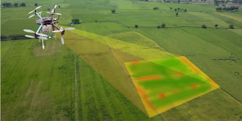
Unmanned aerial photogrammetric survey is the use of unmanned aerial vehicles (UAVs) to take photos for use in photogrammetry, the science of making measurements from photographs. Instruments manufactured for UAVs could be mounted on unmanned flying platforms of various sizes and types, such as octocopters. These machines are suitable for the full geodetic survey of a study site by creating a point cloud of measurements of nearly homogeneous quality and accuracy. These detailed point clouds (of various types of data) could be used in line with orthophotos etc. to obtain a complex data system representing the study site.


Site Location – Pan India
Service Mode – On Site
Service Type – Drone Mapping Service
Type of Technology – Using By Drone
| Settings | Drone Mapping Service remove | Aerial Drone Survey Service remove | Aerial Survey Service remove | Drone Topographical Survey Service remove | Mines Volumetric Drone Survey Service remove | GIS Survey Service remove |
|---|---|---|---|---|---|---|
| Image |  | 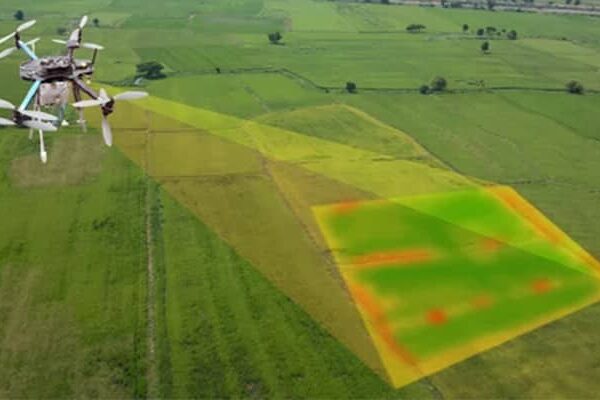 |  | 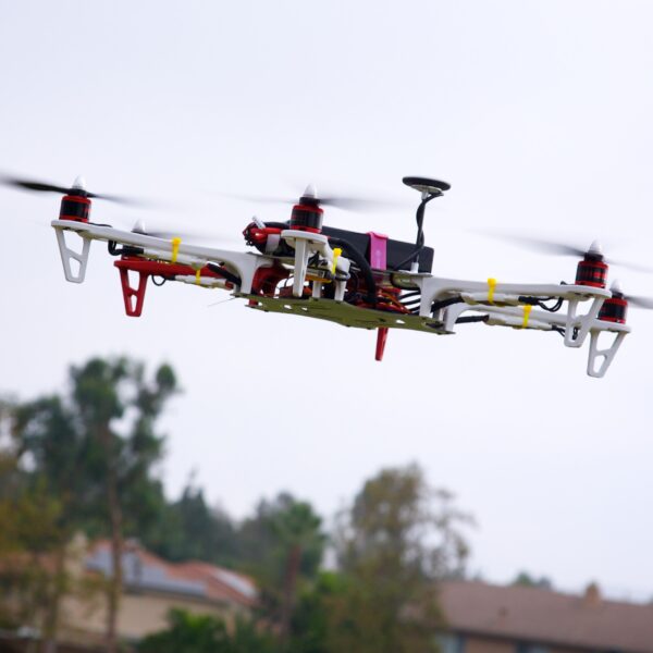 | 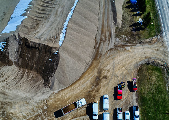 |  |
| SKU | ||||||
| Rating | ||||||
| Price | ||||||
| Stock | ||||||
| Availability | ||||||
| Add to cart | ||||||
| Description | Unmanned aerial photogrammetric survey is the use of unmanned aerial vehicles (UAVs) to take photos for use in photogrammetry, the science of making measurements from photographs. Instruments manufactured for UAVs could be mounted on unmanned flying platforms of various sizes and types, such as octocopters. These machines are suitable for the full geodetic survey of a study site by creating a point cloud of measurements of nearly homogeneous quality and accuracy. These detailed point clouds (of various types of data) could be used in line with orthophotos etc. to obtain a complex data system representing the study site. | Backed by years of experience in this domain, we have been able to offer the finest collection of Aerial Drone Survey. These services are admired for quality assurance and client focus approach. Apartfrom this, our team members remain in close contact with patrons to determine their requirements and render these survey services accordingly. | Technological advances in both video camera equipment and RC (remote control) equipment allow Surveying India to capture cinema quality, full motion imagery. Using state or the art equipment we are able to go where zip lines, cables, camera booms are not, still retaining the integrity of the shot by capturing complicated and challenging footage. Conversely, to previous methods of filmmaking, our set-up and take-down time is quick and efficient. All our projects were met with a great satisfaction among our customers. | With the assistance of our enormously competent land diligent team members, we are involved in offering Drone Survey Service. These interior design work services can be offered as per client preferences. Apart from this, we are rendering these services with the help of the latest technology-based resources. | Backed by our skilled professionals, we are involved in providing Volumetric Survey Service. | Surveying India provides an effective drone mapping system to capture and process photogrammetric data for mining, construction, agriculture and infrastructure projects using the most advance drone in India. Our design software ensures a cost efficient and time saving solution for rapidly mapping and changes in mining, construction, agriculture and infrastructure applications. |
| Content | Site Location - Pan India Service Mode - On Site Service Type - Drone Mapping Service Type of Technology - Using By Drone | Modes - Drone Type - Automapper Site Location - All Over India Area / Size - Any Start Date / Month - As per Client Service Duration - 1-12 Months | Aerial Survey Service in IndiaModes - All Site Location - All Over India Area / Size - Any Start Date / Month - Any Service Duration - 1-12 Months | Measurement Type - Acre Service Mode - Offline Surveying Method - By Drone Type Of Services - Visual Usage/Application - AutoCAD Services Include - 3D and 2D Mapping Service Type - Drone Topographical Survey Service Location - PAN India | Service Type - Mines Volumetric Drone Survey Service Location - PAN India Service Mode - Offline | Area / Size - Any Start Date / Month - Any Certification Need - yes Service Location - All Over India Service Mode - Any Service Duration - 1-12 Months |
| Weight | ||||||
| Dimensions | N/A | N/A | N/A | N/A | N/A | N/A |
| Additional information |