Description
Service Mode – On Site
Service Location – PAN India
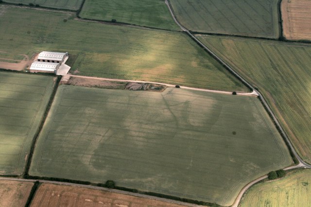
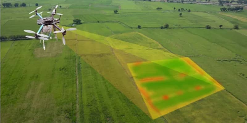
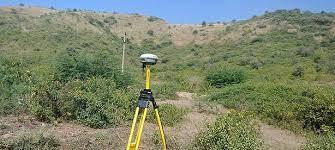
Service Type – Lidar Survey Services
Type of Technology – Using By Drone

LIDAR, or LiDAR; sometimes LADAR) is a method for determining ranges (variable distance) by targeting an object or a surface with a laser and measuring the time for the reflected light to return to the receiver. It can also be used to make digital 3-D representations of areas on the earth’s surface and ocean bottom by varying the wavelength of light. It has terrestrial, airborne, and mobile applications.
Lidar is an acronym of “light detection and ranging” or “laser imaging, detection, and ranging”. It is sometimes called 3-D laser scanning, a special combination of 3-D scanning and laser scanning.
Lidar is commonly used to make high-resolution maps, with applications in surveying, geodesy, geomatics, archaeology, geography, geology, geomorphology, seismology, forestry, atmospheric physics, laser guidance, airborne laser swath mapping (ALSM), and laser altimetry. It is also used in control and navigation for some autonomous cars and for the helicopter Ingenuity on its record-setting flights over the terrain of Mars.


Service Mode – On Site
Service Location – PAN India
Service Type – Lidar Survey Services
Type of Technology – Using By Drone
| Settings | Lidar Survey Services remove | Aerial Survey Service remove | Drone Survey remove | Aerial Drone Survey Service remove | Drone UAV Survey remove | Aerial Mapping Service remove |
|---|---|---|---|---|---|---|
| Image | 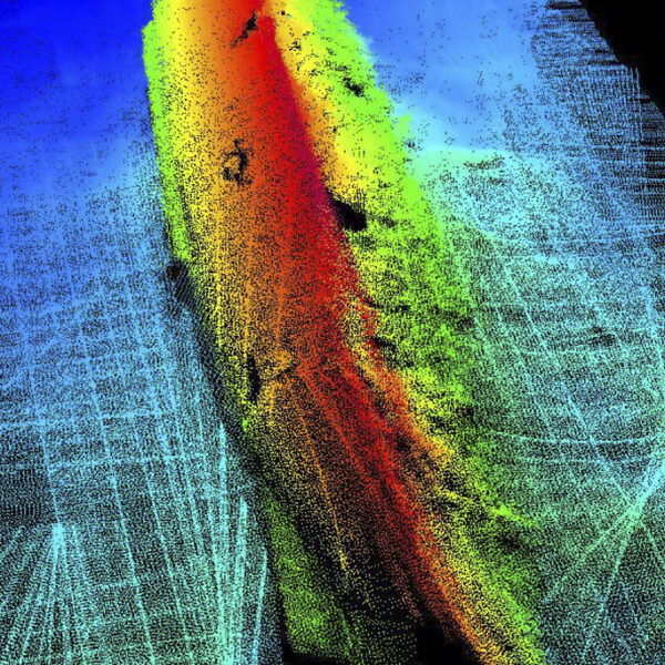 |  |  | 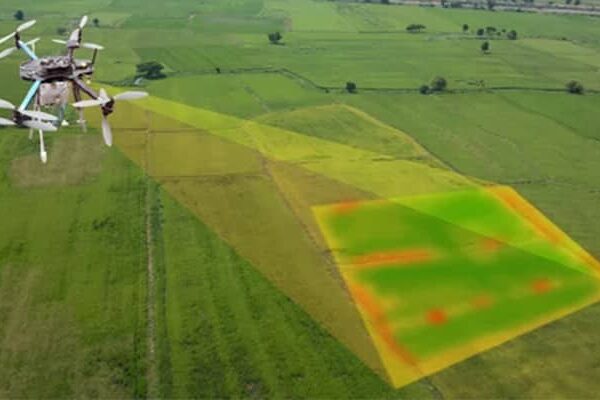 |  |  |
| SKU | ||||||
| Rating | ||||||
| Price | ||||||
| Stock | ||||||
| Availability | ||||||
| Add to cart | ||||||
| Description | LIDAR, or LiDAR; sometimes LADAR) is a method for determining ranges (variable distance) by targeting an object or a surface with a laser and measuring the time for the reflected light to return to the receiver. It can also be used to make digital 3-D representations of areas on the earth's surface and ocean bottom by varying the wavelength of light. It has terrestrial, airborne, and mobile applications. Lidar is an acronym of "light detection and ranging" or "laser imaging, detection, and ranging". It is sometimes called 3-D laser scanning, a special combination of 3-D scanning and laser scanning. Lidar is commonly used to make high-resolution maps, with applications in surveying, geodesy, geomatics, archaeology, geography, geology, geomorphology, seismology, forestry, atmospheric physics, laser guidance, airborne laser swath mapping (ALSM), and laser altimetry. It is also used in control and navigation for some autonomous cars and for the helicopter Ingenuity on its record-setting flights over the terrain of Mars. | Technological advances in both video camera equipment and RC (remote control) equipment allow Surveying India to capture cinema quality, full motion imagery. Using state or the art equipment we are able to go where zip lines, cables, camera booms are not, still retaining the integrity of the shot by capturing complicated and challenging footage. Conversely, to previous methods of filmmaking, our set-up and take-down time is quick and efficient. All our projects were met with a great satisfaction among our customers. | We provides Drone/Unmanned Aerial Vehicle (UAV) services to both industry and government, covering a wide and varied range of tasks such as UAV inspection and survey, crisis management, radio tower, telecommunications links, industrial building, quarry, wind turbine, chimney, manufacturing works, bridge, rock face or other piece of infrastructure, and also deploy rapid reaction response teams to deal with emergencies and capable to reach places that are difficult, expensive, dangerous, ‘live’ or even impossible to approach by manned inspection teams. | Backed by years of experience in this domain, we have been able to offer the finest collection of Aerial Drone Survey. These services are admired for quality assurance and client focus approach. Apartfrom this, our team members remain in close contact with patrons to determine their requirements and render these survey services accordingly. | Our organization is offering an assorted range of UAV Survey. We are working dedicatedly to catering to the requirement of the client. Apart from this, our professionals make honest efforts to provide this survey service within the assured set of time. | Through regular improvement, we are offering an exclusive collection of Aerial Mapping Service. Our highly skilledprofessionals render this offered mapping service on well-defined parameters. Offered array of mapping services is rendered using best grade inputs.
|
| Content | Service Mode - On Site Service Location - PAN India Service Type - Lidar Survey Services Type of Technology - Using By Drone | Aerial Survey Service in IndiaModes - All Site Location - All Over India Area / Size - Any Start Date / Month - Any Service Duration - 1-12 Months | Modes - Drone Type - Automapper Site Location - All Over India Area / Size - Any Start Date / Month - As per Client Service Duration - 1-12 Months | Site Location - All Over India Area / Size - Any Start Date / Month - Any Is It Mobile Access - Mobile Access | ||
| Weight | ||||||
| Dimensions | N/A | N/A | N/A | N/A | N/A | N/A |
| Additional information |