| Description | Complete Aerial Survey & Mapping
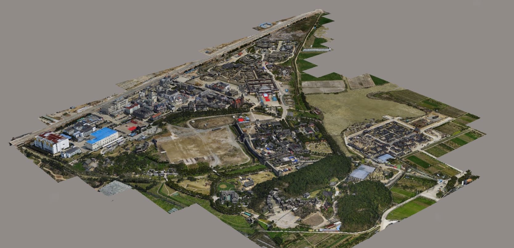
Gis Data Processing & Analysis | We are one of the foremost firms of 3D Mapping Service. These services are enormously well-liked in the market for their nominal rates and consistency. | Technological advances in both video camera equipment and RC (remote control) equipment allow Surveying India to capture cinema quality, full motion imagery. Using state or the art equipment we are able to go where zip lines, cables, camera booms are not, still retaining the integrity of the shot by capturing complicated and challenging footage. Conversely, to previous methods of filmmaking, our set-up and take-down time is quick and efficient. All our projects were met with a great satisfaction among our customers. | Surveying India specializes in Aerial Contours. Contour lines are generated by connecting all the points of similar elevation together. These lines are drawn on a plan of a particular terrain to understand the nature of surface, identify cut fill volume, study water flow characteristics, estimate valley depth and steepness. Contour lines form a smooth curve of same elevation points. Contour lines are also called as isohypse, isoline, isopleth, or isarithm. |
- PROJECT CONSTRUCTION MONITORING
- RAILWAY ASSET MAPPING
- BRIDGE INSPECTION
- NH MONITORING
| Topographic Land Surveying Drone Services. |
| Content | We provide an all-in-one mapping & survey solution for a variety of industrial purposes as we are well equipped with UAV and LiDAR technologies. We organise and work with your data accurately to generate ready-to-use reports for decision making in operations and planning. | Scope Of Survey - All
Usage/Application - AutoCAD
Type Of Services - Visual
Surveying Method - By Drone
Service Location - PAN India
Service Mode - Offline
Service Type - 3D Mapping Drone | Aerial Survey Service in India
Modes - All
Site Location - All Over India
Area / Size - Any
Start Date / Month - Any
Service Duration - 1-12 Months | Type - Site
Service Mode - Offline | | Services Include - 3D and 2D Mapping
Usage/Application - AutoCAD and Global Mapper
Service Mode - Offline
Measurement Type - Acre
Surveying Method - By Drone
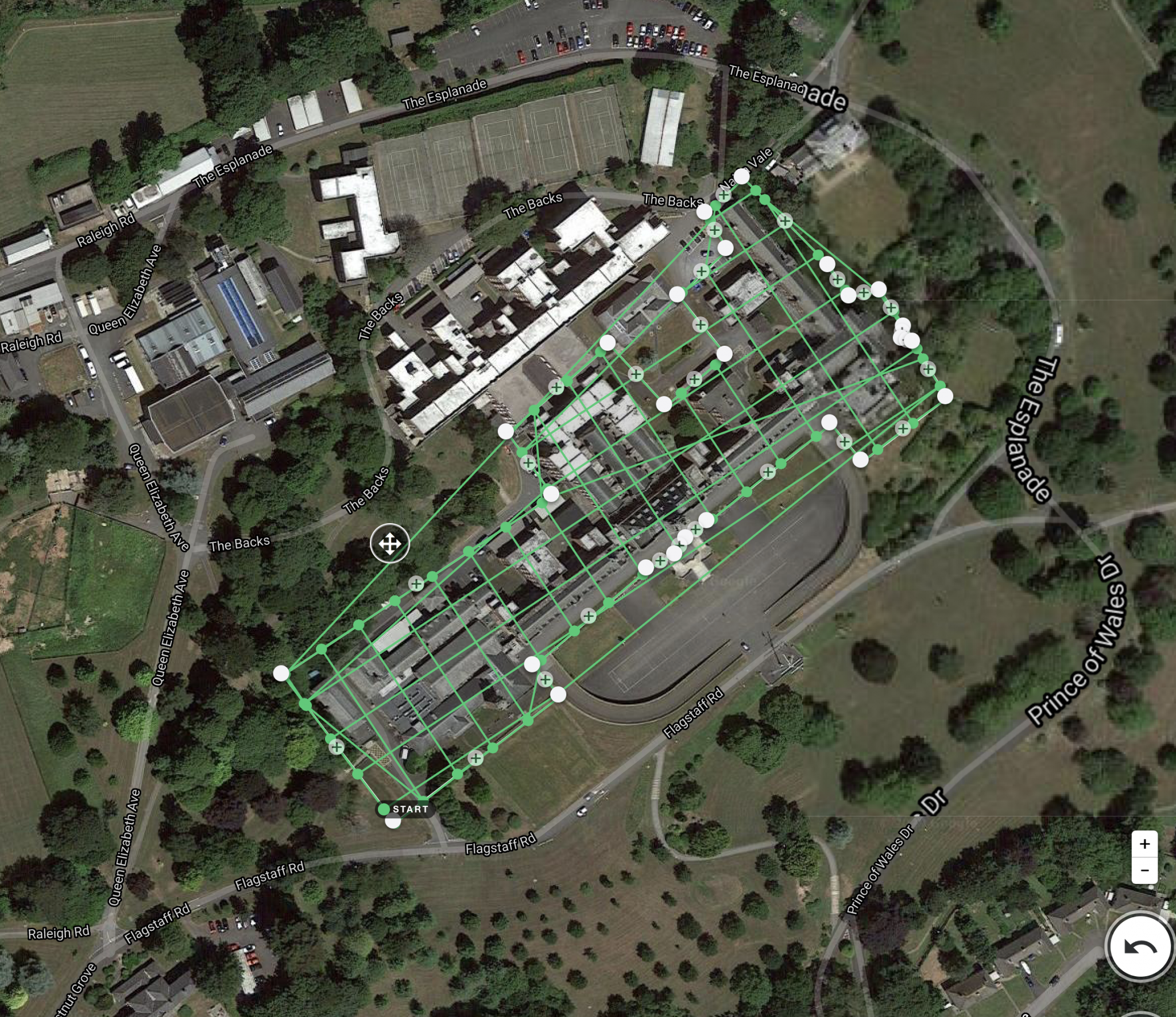
Service Type - Topographic Land Surveying Drone
Service Location - PAN India |