Description
Surveying Location – Any
Area / Size – Any
Start Date / Month – Any
Site Location – Any
Service Duration – 1-12 Months
Service Location – All Over India

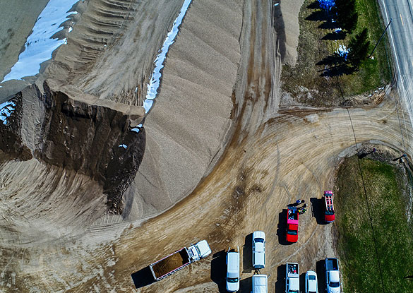
Enriched with vast industrial practice, we are involved in offering Bridges And Roads Surveying Service. Owing to timely completion, these are vastly well-liked by customers. For this service, we selected expert’s team who has affluent industry practice and proficiency. Moreover, we render this service as per client’s demand.


Surveying Location – Any
Area / Size – Any
Start Date / Month – Any
Site Location – Any
Service Duration – 1-12 Months
Service Location – All Over India
| Settings | Bridge Roads Surveying Service remove | Topographic Land Surveying Drone Services remove | Drone Mine Topographic Survey Services remove | Drone Survey remove | DGPS Survey Services remove | Aerial Contours remove |
|---|---|---|---|---|---|---|
| Image | |  | 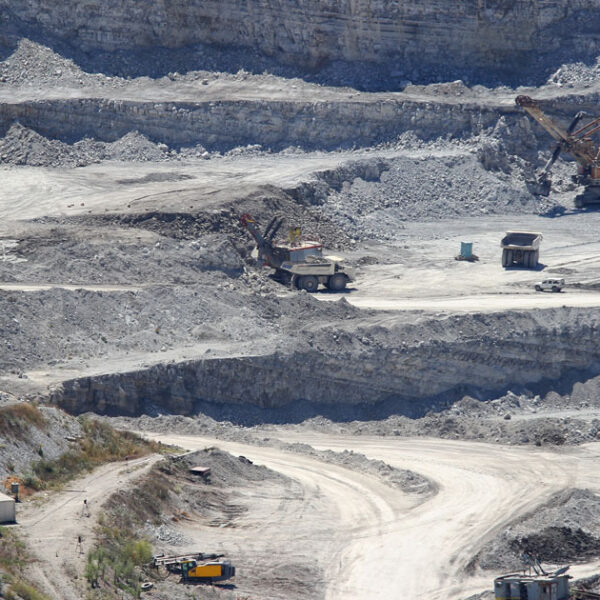 |  | 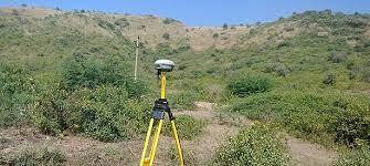 |  |
| SKU | ||||||
| Rating | ||||||
| Price | ||||||
| Stock | ||||||
| Availability | ||||||
| Add to cart | ||||||
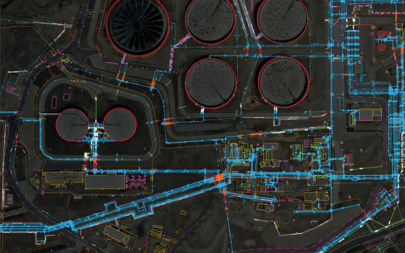
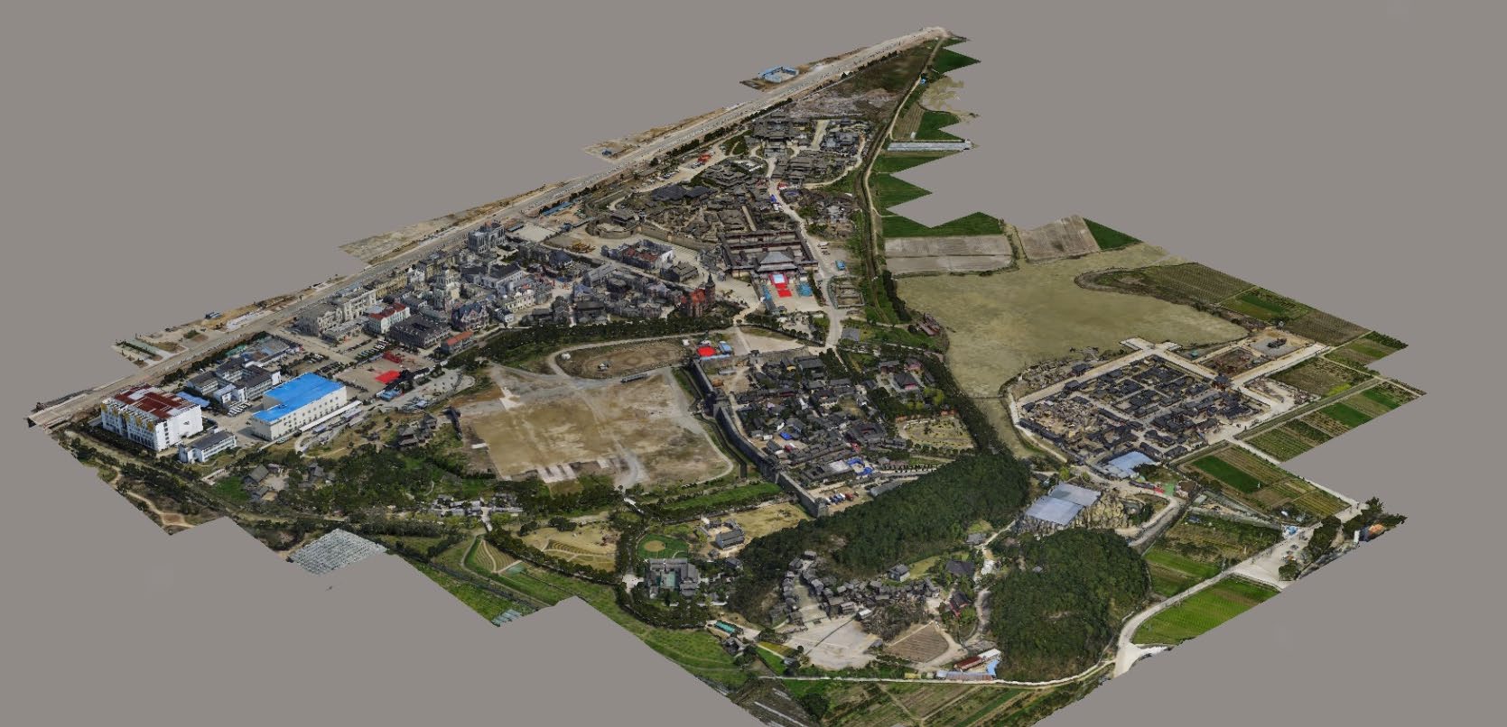
| Description | Enriched with vast industrial practice, we are involved in offering Bridges And Roads Surveying Service. Owing to timely completion, these are vastly well-liked by customers. For this service, we selected expert’s team who has affluent industry practice and proficiency. Moreover, we render this service as per client’s demand. | Topographic Land Surveying Drone Services. | We at Pixroot Technologies Private Limited specialized in providing high-quality Drone Survey Services. We are Kolkata's one of the best Drone Survey Company & India's one of the fastest growing "Drone Survey" companies providing high accuracy using the latest technology. We've consistently been recognized for our on-time results delivery and quality services. In mining we are executing the work as per new rules of IBM/MCDR updated new rule guidelines. | We provides Drone/Unmanned Aerial Vehicle (UAV) services to both industry and government, covering a wide and varied range of tasks such as UAV inspection and survey, crisis management, radio tower, telecommunications links, industrial building, quarry, wind turbine, chimney, manufacturing works, bridge, rock face or other piece of infrastructure, and also deploy rapid reaction response teams to deal with emergencies and capable to reach places that are difficult, expensive, dangerous, ‘live’ or even impossible to approach by manned inspection teams. | Supported by highly accomplished crew of employees, we are rendering DGPS Survey Service. These provided services are delivered under the stern supervision of adroit personnel as per set industry principles. In addition to this, these provided services are attributed amid our client for reliability and cost effectiveness. | Surveying India specializes in Aerial Contours. Contour lines are generated by connecting all the points of similar elevation together. These lines are drawn on a plan of a particular terrain to understand the nature of surface, identify cut fill volume, study water flow characteristics, estimate valley depth and steepness. Contour lines form a smooth curve of same elevation points. Contour lines are also called as isohypse, isoline, isopleth, or isarithm. |
| Content | Surveying Location - Any Area / Size - Any Start Date / Month - Any Site Location - Any Service Duration - 1-12 Months Service Location - All Over India | Services Include - 3D and 2D Mapping Usage/Application - AutoCAD and Global Mapper Service Mode - Offline Measurement Type - Acre Surveying Method - By Drone Service Type - Topographic Land Surveying Drone Service Location - PAN India | Survey Type - 2D and 3D Mapping Usage/Application - AutoCAD and Global Mapper Surveying Location - Mines Service Mode - Offline Measurement Type - Acre Surveying Method - By Drone Service Type - Drone Mine Survey Service Location - PAN India | Site Location - PAN India Mode Of Report - Excel Service Type - DGPS Survey Service Mode - Offline | Type - Site Service Mode - Offline | |
| Weight | ||||||
| Dimensions | N/A | N/A | N/A | N/A | N/A | N/A |
| Additional information |