Description
Service Mode – Onsite
Service Location – PAN India
Service Type – Drone Surveying Service
Type of Technology – Using By Drone

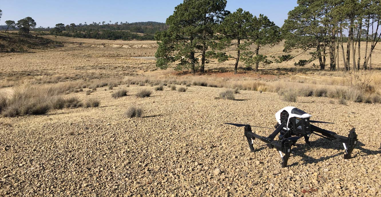
Aerial survey is a method of collecting geomatics or other imagery by using airplanes, helicopters, UAVs, balloons or other aerial methods. Typical types of data collected include aerial photography, Lidar, remote sensing (using various visible and invisible bands of the electromagnetic spectrum, such as infrared, gamma, or ultraviolet) and also geophysical data (such as aeromagnetic surveys and gravity. It can also refer to the chart or map made by analysing a region from the air. Aerial survey should be distinguished from satellite imagery technologies because of its better resolution, quality and atmospheric conditions (which can negatively impact and obscure satellite observation). Today, aerial survey is sometimes recognized as a synonym for aero photogrammetry, part of photogrammetry where the camera is placed in the air. Measurements on aerial images are provided by photogrammetric technologies and methods.[1]
Aerial surveys can provide information on many things not visible from the ground.


Service Mode – Onsite
Service Location – PAN India
Service Type – Drone Surveying Service
Type of Technology – Using By Drone
| Settings | Drone Survey Service remove | 3D Mining Drone Mapping Service remove | Aerial Contours remove | Drone UAV Survey remove | Topographic Land Surveying Drone Services remove | Survey Mapping Drone Service remove |
|---|---|---|---|---|---|---|
| Image |  |  |  |  | | 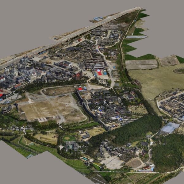 |
| SKU | ||||||
| Rating | ||||||
| Price | ||||||
| Stock | ||||||
| Availability | ||||||
| Add to cart | ||||||
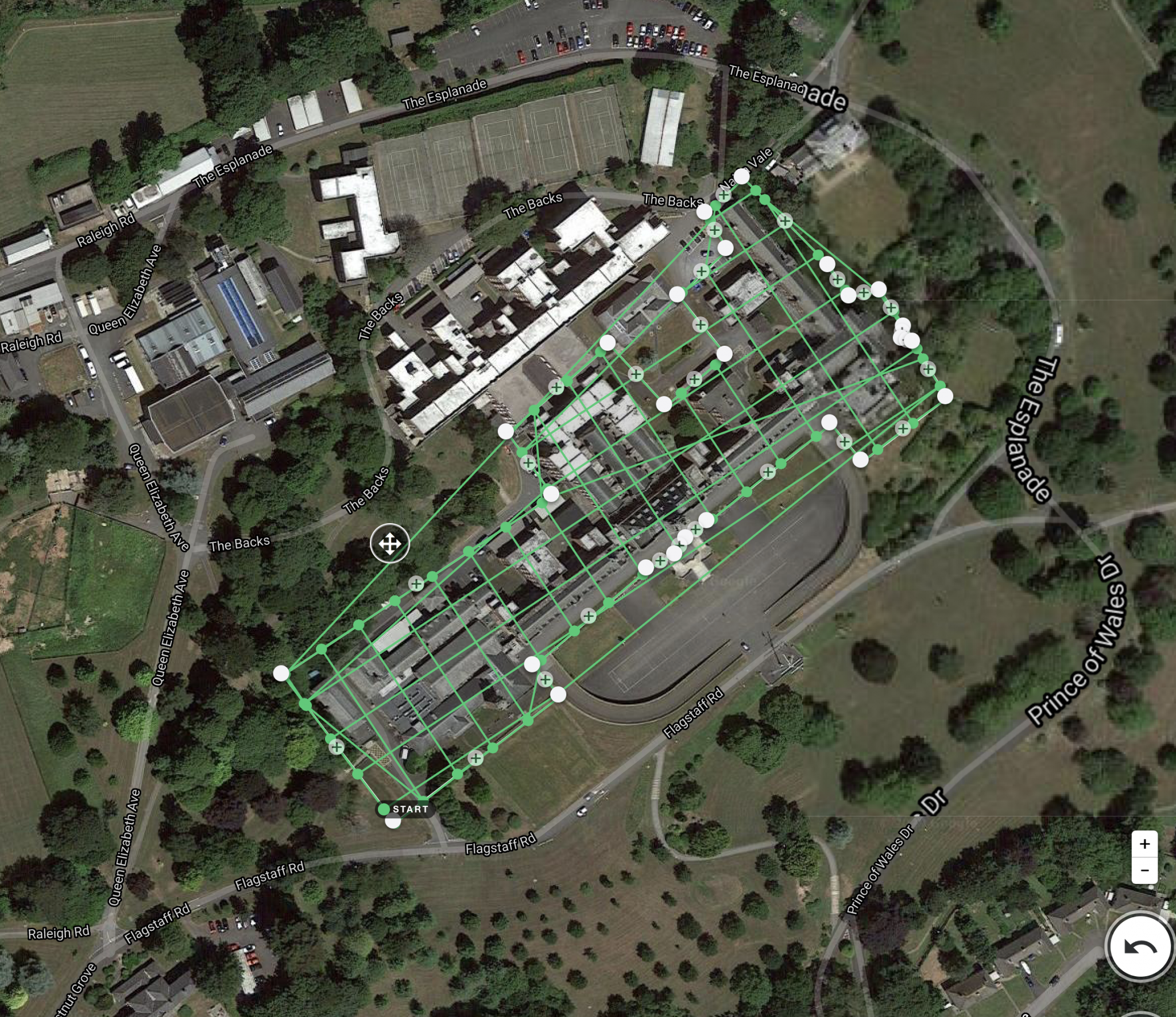
| Description | Aerial survey is a method of collecting geomatics or other imagery by using airplanes, helicopters, UAVs, balloons or other aerial methods. Typical types of data collected include aerial photography, Lidar, remote sensing (using various visible and invisible bands of the electromagnetic spectrum, such as infrared, gamma, or ultraviolet) and also geophysical data (such as aeromagnetic surveys and gravity. It can also refer to the chart or map made by analysing a region from the air. Aerial survey should be distinguished from satellite imagery technologies because of its better resolution, quality and atmospheric conditions (which can negatively impact and obscure satellite observation). Today, aerial survey is sometimes recognized as a synonym for aero photogrammetry, part of photogrammetry where the camera is placed in the air. Measurements on aerial images are provided by photogrammetric technologies and methods.[1] Aerial surveys can provide information on many things not visible from the ground. | 3D Mining Drone Mapping Service. | Surveying India specializes in Aerial Contours. Contour lines are generated by connecting all the points of similar elevation together. These lines are drawn on a plan of a particular terrain to understand the nature of surface, identify cut fill volume, study water flow characteristics, estimate valley depth and steepness. Contour lines form a smooth curve of same elevation points. Contour lines are also called as isohypse, isoline, isopleth, or isarithm. | Our organization is offering an assorted range of UAV Survey. We are working dedicatedly to catering to the requirement of the client. Apart from this, our professionals make honest efforts to provide this survey service within the assured set of time. | Topographic Land Surveying Drone Services. | |
| Content | Service Mode - Onsite Service Location - PAN India Service Type - Drone Surveying Service Type of Technology - Using By Drone | Usage/Application - AutoCAD and Global Mapper Surveying Method - By Drone Service Location - PAN India Service Mode - Offline | Type - Site Service Mode - Offline | Services Include - 3D and 2D Mapping Usage/Application - AutoCAD and Global Mapper Service Mode - Offline Measurement Type - Acre Surveying Method - By Drone Service Type - Topographic Land Surveying Drone Service Location - PAN India | Service Type - Survey Mapping Service Location - PAN India Service Mode - Offline | |
| Weight | ||||||
| Dimensions | N/A | N/A | N/A | N/A | N/A | N/A |
| Additional information |