Description
Service Location – Pan India
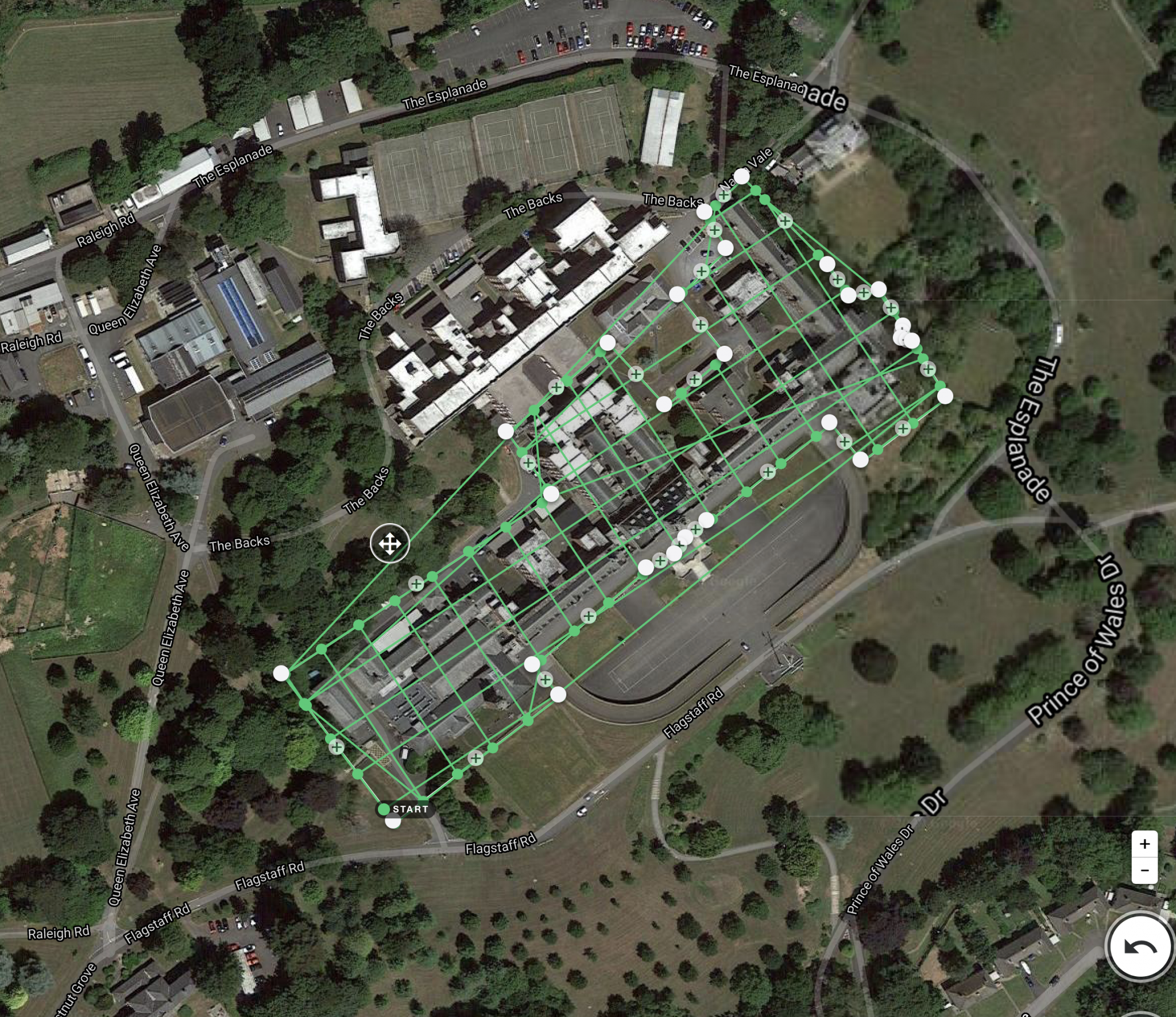
Service Type – Geographic Information System Services
Service Mode – On site
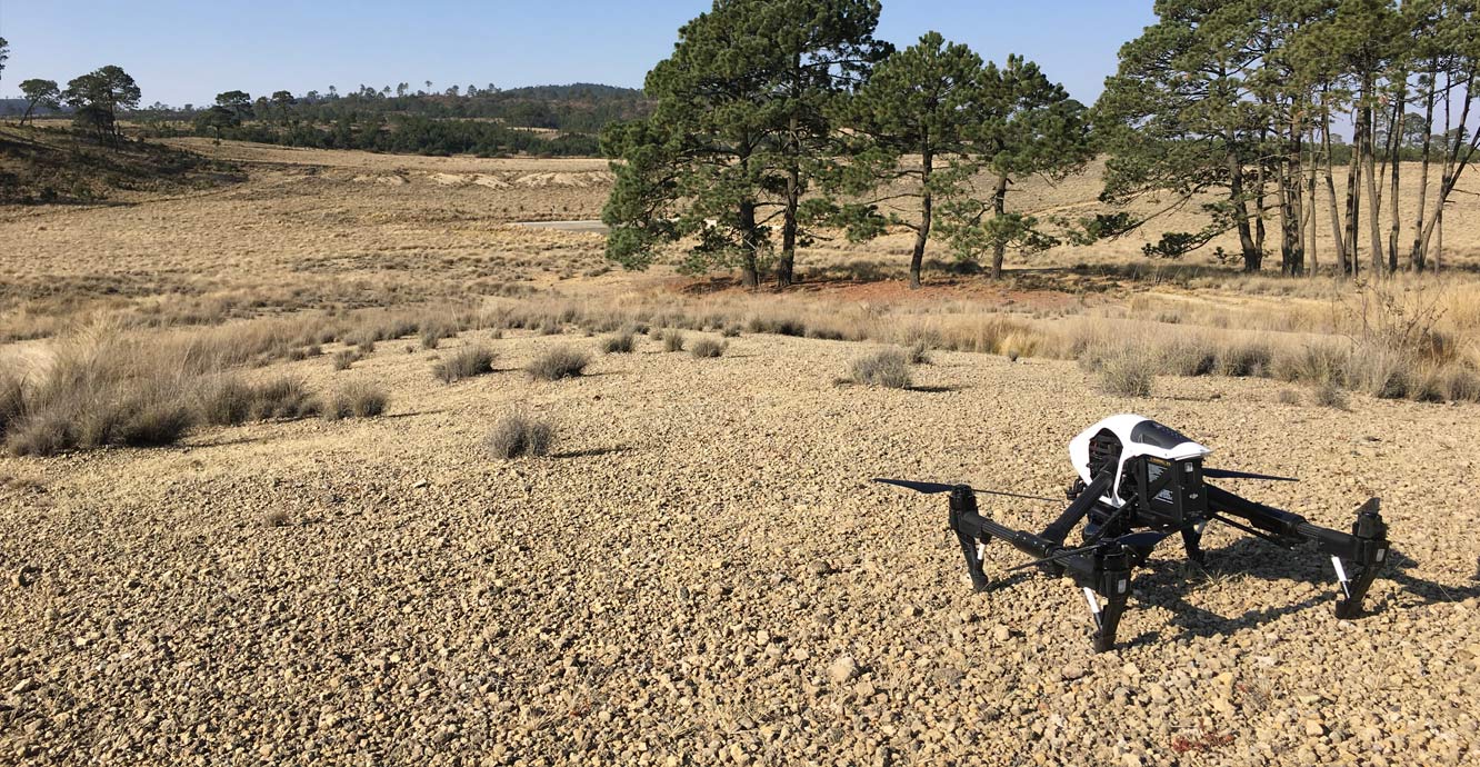
Type of Technology – Using Drone

A geographic information system (GIS) is a type of database containing geographic data (that is, descriptions of phenomena for which location is relevant), combined with software tools for managing, analyzing, and visualizing those data. In a broader sense, one may consider such a system to also include human users and support staff, procedures and workflows, body of knowledge of relevant concepts and methods, and institutional organizations.
The uncounted plural, geographic information systems, also abbreviated GIS, is the most common term for the industry and profession concerned with these systems. It is roughly synonymous with geoinformatics and part of the broader geospatial field, which also includes GPS, remote sensing, etc. Geographic information science, the academic discipline that studies these systems and their underlying geographic principles, may also be abbreviated as GIS, but the unambiguous GIScience is more common.
Geographic information systems are utilized in multiple technologies, processes, techniques and methods. They are attached to various operations and numerous applications, that relate to: engineering, planning, management, transport/logistics, insurance, telecommunications, and business. For this reason, GIS and location intelligence applications are at the foundation of location-enabled services, which rely on geographic analysis and visualization.


Service Location – Pan India
Service Type – Geographic Information System Services
Service Mode – On site
Type of Technology – Using Drone
| Settings | GIS Surveying and Mapping Services remove | Aerial Mapping Service remove | Geological Drone Survey remove | Mines Volumetric Drone Survey Service remove | 3D Mapping Drone Service remove | DGPS Survey Services remove |
|---|---|---|---|---|---|---|
| Image |  |  |  | 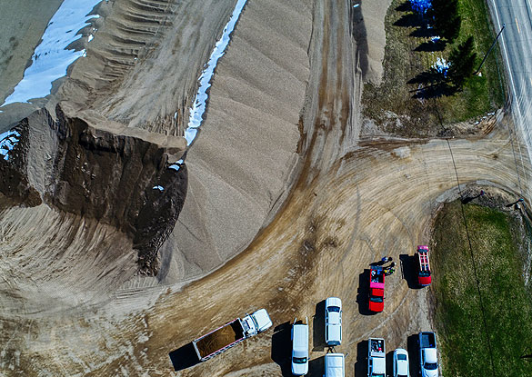 |  | 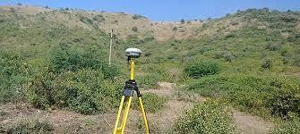 |
| SKU | ||||||
| Rating | ||||||
| Price | ||||||
| Stock | ||||||
| Availability | ||||||
| Add to cart | ||||||
| Description | A geographic information system (GIS) is a type of database containing geographic data (that is, descriptions of phenomena for which location is relevant), combined with software tools for managing, analyzing, and visualizing those data. In a broader sense, one may consider such a system to also include human users and support staff, procedures and workflows, body of knowledge of relevant concepts and methods, and institutional organizations. The uncounted plural, geographic information systems, also abbreviated GIS, is the most common term for the industry and profession concerned with these systems. It is roughly synonymous with geoinformatics and part of the broader geospatial field, which also includes GPS, remote sensing, etc. Geographic information science, the academic discipline that studies these systems and their underlying geographic principles, may also be abbreviated as GIS, but the unambiguous GIScience is more common. Geographic information systems are utilized in multiple technologies, processes, techniques and methods. They are attached to various operations and numerous applications, that relate to: engineering, planning, management, transport/logistics, insurance, telecommunications, and business. For this reason, GIS and location intelligence applications are at the foundation of location-enabled services, which rely on geographic analysis and visualization. | Through regular improvement, we are offering an exclusive collection of Aerial Mapping Service. Our highly skilledprofessionals render this offered mapping service on well-defined parameters. Offered array of mapping services is rendered using best grade inputs.
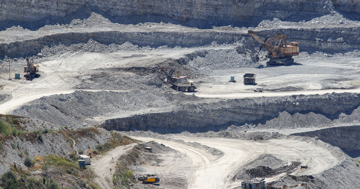
| Our organization is offering a large array of Geological Surveying Services to our valued clients. Rendered as per client need, these are used in various fields. In addition to this, the offered array of interior designing services is rendered using the latest technology and top-grade materials within a limited period. | Backed by our skilled professionals, we are involved in providing Volumetric Survey Service. | We are one of the foremost firms of 3D Mapping Service. These services are enormously well-liked in the market for their nominal rates and consistency. | Supported by highly accomplished crew of employees, we are rendering DGPS Survey Service. These provided services are delivered under the stern supervision of adroit personnel as per set industry principles. In addition to this, these provided services are attributed amid our client for reliability and cost effectiveness. |
| Content | Service Location - Pan India Service Type - Geographic Information System Services Service Mode - On site Type of Technology - Using Drone | Site Location - All Over India Area / Size - Any Start Date / Month - Any Is It Mobile Access - Mobile Access | Services Include - 3D and 2D Mapping Usage/Application - AutoCAD Type Of Services - Visual Surveying Method - By Drone Service Type - Geological Drone Survey Service Location - PAN India Service Mode - Offline | Service Type - Mines Volumetric Drone Survey Service Location - PAN India Service Mode - Offline | Scope Of Survey - All Usage/Application - AutoCAD Type Of Services - Visual Surveying Method - By Drone Service Location - PAN India Service Mode - Offline Service Type - 3D Mapping Drone | Site Location - PAN India Mode Of Report - Excel Service Type - DGPS Survey Service Mode - Offline |
| Weight | ||||||
| Dimensions | N/A | N/A | N/A | N/A | N/A | N/A |
| Additional information |