| Description | Our high-tech drones are equipped with cutting-edge sensors, providing real-time data that enables construction professionals to make better decisions. Our services include aerial surveys, mapping, inspection, and progress monitoring. By leveraging our expertise, construction companies can reduce costs, improve efficiency, and enhance safety on the job site.
Let Drogo Drones take your construction project to new heights.
Contact us to and avail a Free consultation NOW!
Stay connected with us
https://linktr.ee/drogodrones
| Elevate Your Vision with Dronimagination's Cinematic Drone Services!
At Dronimagination Pvt Ltd, we are passionate about transforming ordinary moments into extraordinary cinematic experiences. Our drone services are designed to take your film, video, or photography projects to new heights, quite literally! With a fleet of professional-grade drones and a team of skilled pilots and cinematographers, we offer a world of creative possibilities for your next production.
Key Benefits:
Aerial Perspectives: Capture breathtaking aerial shots and stunning panoramic views that were once unimaginable. Our drones provide a unique vantage point that adds depth and drama to your storytelling.
Smooth and Stable Footage: Our drones are equipped with advanced stabilization technology, ensuring that your footage is silky smooth, even in challenging weather conditions.
Flexibility: Our drones can adapt to a wide range of filming scenarios, from dynamic action sequences to serene landscape shots. We work closely with you to capture your vision with precision.
Efficiency: Eliminate the need for expensive cranes, helicopters, and large camera crews. Our drones offer a cost-effective and efficient solution to capture aerial footage.
Innovation: Stay ahead of the curve with cutting-edge equipment and techniques in aerial cinematography. We are dedicated to embracing the latest advancements in the field.
Safety: Our team prioritizes safety above all else. We operate within legal regulations, ensuring a secure and responsible approach to aerial cinematography.
Applications:
Feature Films: Add grandeur and drama to your cinematic masterpiece with sweeping aerial shots and dynamic sequences.
Commercials: Create visually stunning and memorable ads that leave a lasting impact on your audience.
Documentaries: Enhance your storytelling by showcasing the world from a unique perspective, whether it's wildlife, geography, or historical landmarks.
Events: Capture the magic of weddings, concerts, and festivals with cinematic flair.
Real Estate: Showcase properties from a stunning aerial viewpoint to attract potential buyers or renters.
Tourism: Promote tourist destinations and attractions with captivating aerial visuals.
Music Videos: Add an extra layer of creativity to music videos with innovative aerial shots and effects.
Dronimagination's cinematic drone services empower you to capture the world like never before, turning your creative vision into a reality. Whether you're a filmmaker, videographer, or photographer, we're here to provide you with the tools and expertise to create compelling, awe-inspiring content.
Contact to learn more about how our drone cinematography services can elevate your projects and help you achieve cinematic excellence. | We Skymap Geo-Infomatic Pvt. Ltd. is a Geospatial & Engineering Consultancy Company that is based in Delhi India.
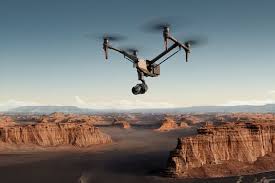
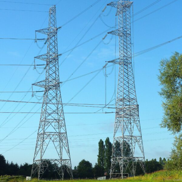
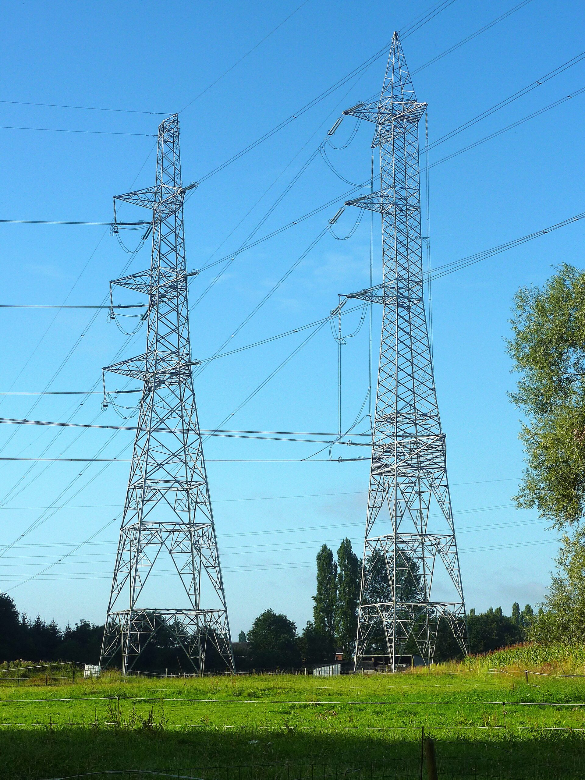
Skymap Company technologies in providing like Photogrammetry, Geographical Information System (GIS), Unmanned Aerial Vehicle (UAV), LIDAR, Satellite based , Asset Mapping, Inspection of assets, Topography Survey, Remote Sensing that can help to client to some problem and favourable time in different Dominion. | Conduct inspections of infrastructure like bridges, power lines, and cell towers to assess their condition and identify potential issues. |
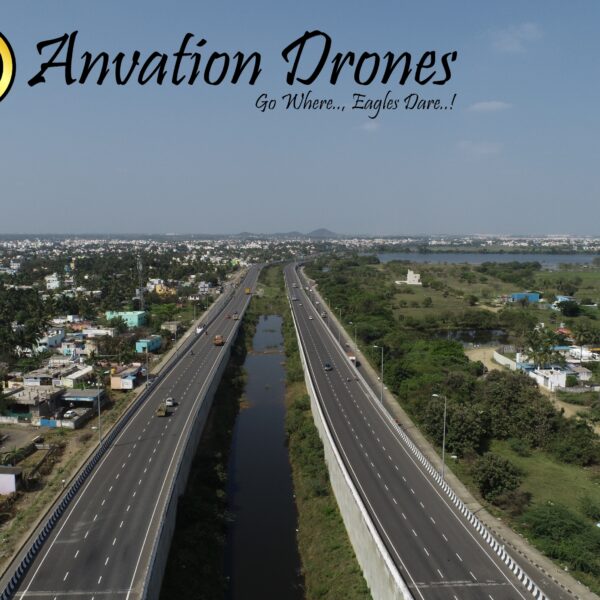
- PROJECT CONSTRUCTION MONITORING
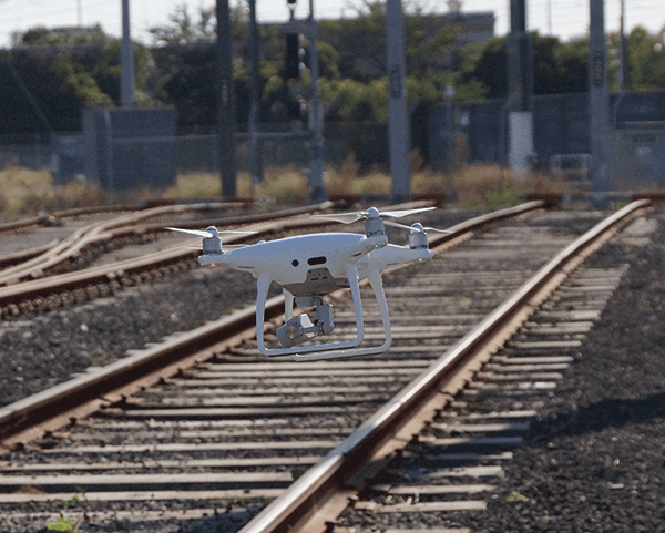
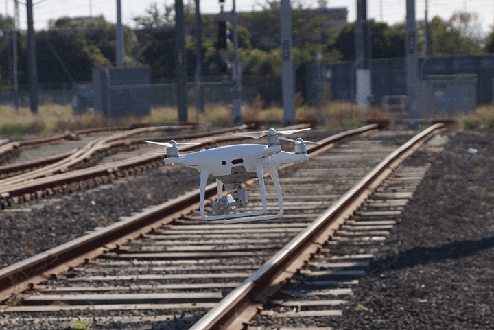
- RAILWAY ASSET MAPPING
- BRIDGE INSPECTION
- NH MONITORING
| We Skymap Geo-Infomatic Pvt. Ltd. is a Geospatial & Engineering Consultancy Company that is based in Delhi India.
Skymap Company technologies in providing like Photogrammetry, Geographical Information System (GIS), Unmanned Aerial Vehicle (UAV), LIDAR, Satellite based , Asset Mapping, Inspection of assets, Topography Survey, Remote Sensing that can help to client to some problem and Favourable time in different Dominion. |
| Content | | | | Improved safety, reduced downtime, and detailed visual reports.
| | Service Location - Pan India
Way of Survey - Exploratory Research
Type of Technology - Drone |
")