Description
Modes – both
Site Location – Any
service Location – All Over India
Service Duration – 1-12 Months
")
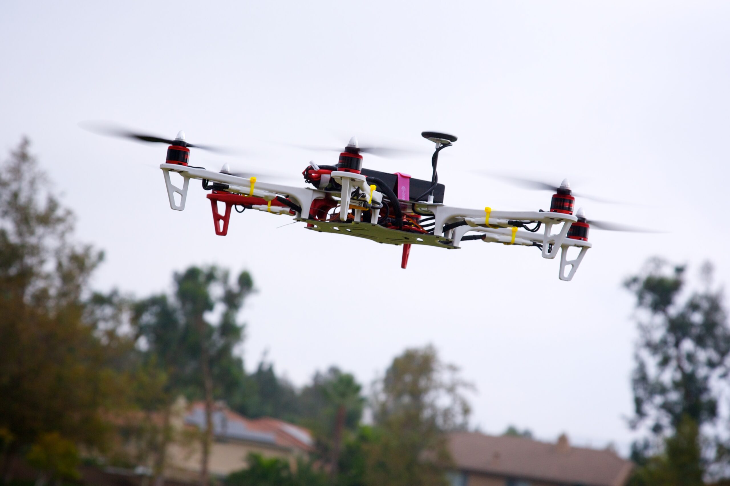
We specializes in capturing aerial imagery at various heights using unmanned aerial aircrafts, also known as Drone, UAV or UAS, equipped with high-resolution cameras and multi-axial gimbal. This technology enables us to operate in a fast, flexible and cost saving manner. Since we fly below cloud cover we can operate on many more days compared to manned aerial photography missions. Flying at low altitudes yields unique and ultra-sharp images in which every detail is visible.


Modes – both
Site Location – Any
service Location – All Over India
Service Duration – 1-12 Months
| Settings | Aerial Imaging remove | GIS Mapping Drone Survey Service remove | Drone Mapping remove | Drone UAV Survey remove | GIS Survey Service remove | Railways and Roadways Planning and Progression Monitoring remove |
|---|---|---|---|---|---|---|
| Image |  | 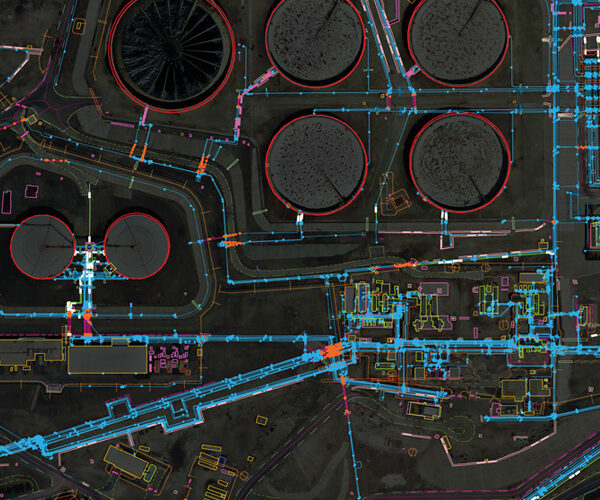 | |  |  |  |
| SKU | ||||||
| Rating | ||||||
| Price | ||||||
| Stock | ||||||
| Availability | ||||||
| Add to cart | ||||||
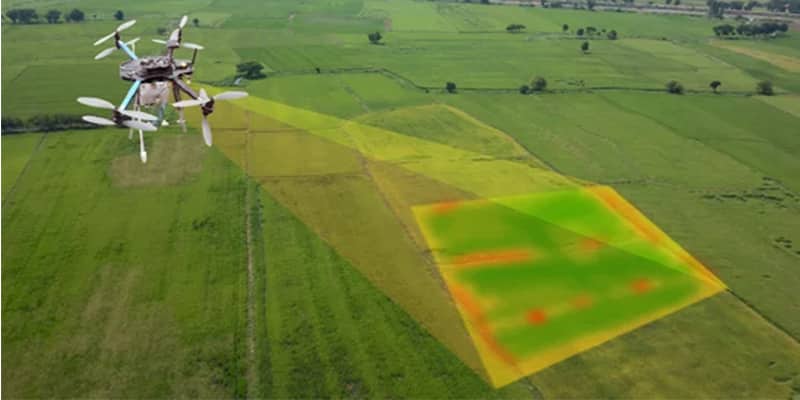
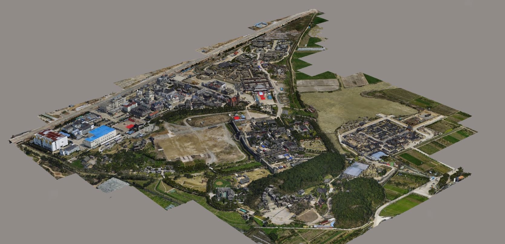
| Description | We specializes in capturing aerial imagery at various heights using unmanned aerial aircrafts, also known as Drone, UAV or UAS, equipped with high-resolution cameras and multi-axial gimbal. This technology enables us to operate in a fast, flexible and cost saving manner. Since we fly below cloud cover we can operate on many more days compared to manned aerial photography missions. Flying at low altitudes yields unique and ultra-sharp images in which every detail is visible. | In order to grab the higher position of the industry, we offer a wide range of GIS Mapping Service. The provided service is rendered using advanced technology. Owing to its flawless execution, and perfect work, this mapping service is valued by our honored clients. | We provides Drone/Unmanned Aerial Vehicle (UAV) services to both industry and government, covering a wide and varied range of tasks such as UAV inspection and survey, crisis management, radio tower, telecommunications links, industrial building, quarry, wind turbine, chimney, manufacturing works, bridge, rock face or other piece of infrastructure, and also deploy rapid reaction response teams to deal with emergencies and capable to reach places that are difficult, expensive, dangerous, ‘live’ or even impossible to approach by manned inspection teams. | Our organization is offering an assorted range of UAV Survey. We are working dedicatedly to catering to the requirement of the client. Apart from this, our professionals make honest efforts to provide this survey service within the assured set of time. | Surveying India provides an effective drone mapping system to capture and process photogrammetric data for mining, construction, agriculture and infrastructure projects using the most advance drone in India. Our design software ensures a cost efficient and time saving solution for rapidly mapping and changes in mining, construction, agriculture and infrastructure applications. |
|
| Content | Modes - both Site Location - Any service Location - All Over India Service Duration - 1-12 Months | Survey Type - GIS Mapping Survey Scope Of Survey - All Services Include - 3D and 2D Mapping Usage/Application - AutoCAD Type Of Services - Visual Surveying Method - By Drone Service Mode - Offline | Area / Size - Any Start Date / Month - Any Certification Need - yes Service Location - All Over India Service Mode - Any Service Duration - 1-12 Months | |||
| Weight | ||||||
| Dimensions | N/A | N/A | N/A | N/A | N/A | N/A |
| Additional information |