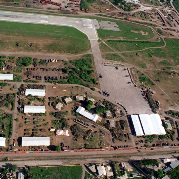
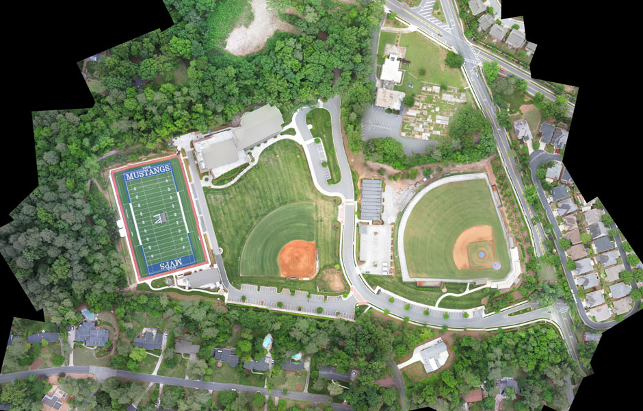
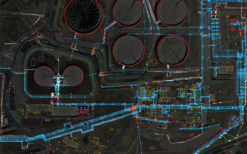
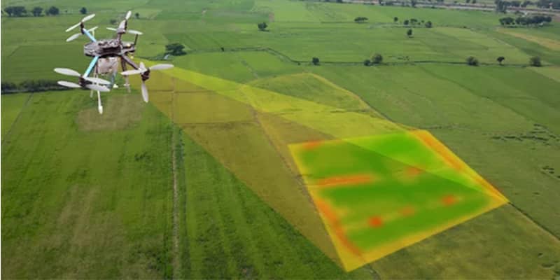
| Description | 2D and 3D mapping can be utilized in the administration of Building or Structures, in Agriculture, in Forest Service, in Mining Industries, Land Soil Development, in Pollution Control, in Flood Management, in Planning Presentation and so on. | Surveying India specializes in Aerial Contours. Contour lines are generated by connecting all the points of similar elevation together. These lines are drawn on a plan of a particular terrain to understand the nature of surface, identify cut fill volume, study water flow characteristics, estimate valley depth and steepness. Contour lines form a smooth curve of same elevation points. Contour lines are also called as isohypse, isoline, isopleth, or isarithm. | Surveying India provides an effective drone mapping system to capture and process photogrammetric data for mining, construction, agriculture and infrastructure projects using the most advance drone in India. Our design software ensures a cost efficient and time saving solution for rapidly mapping and changes in mining, construction, agriculture and infrastructure applications. | |
Through regular improvement, we are offering an exclusive collection of Aerial Mapping Service. Our highly skilledprofessionals render this offered mapping service on well-defined parameters. Offered array of mapping services is rendered using best grade inputs.
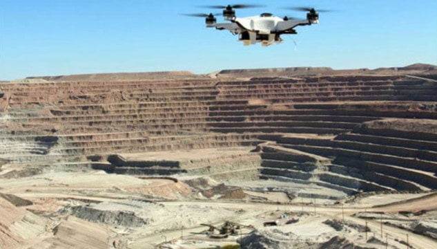
| Topographic Land Surveying Drone Services. |
| Content | 2D/3D mapping is made with our unmanned drones following a pre-designed flight way, which gathers an large grouping of overlapping geo-tagged images. The information or images, data is then produce to specific mapping software to designed to make a 2D topographic map, 3D display or to extract land or property estimations from the information which gathered.
2D and 3D mapping is the most used tool from Aerizone and gives communicative answers for the owner administration, make idea and building management utilizing models of terrain, an estate or property. This permits our clients better route of overview of survey and can be utilized across over different applications or within the presentation.
While making a 2D or 3D mapping using Arial technology, the fundamental focus is on where the drone camera is pointed and whether you are requiring a map or making models of statues and so forth. This procedure requires numerous photographs to be taken by the drone from a particular flight path, or waypoint that are basically covered to make the required final result. | Type - Site
Service Mode - Offline | Area / Size - Any
Start Date / Month - Any
Certification Need - yes
Service Location - All Over India
Service Mode - Any
Service Duration - 1-12 Months | Usage/Application - Volume of the commodity
Mode Of Report - Hard Copy | Site Location - All Over India
Area / Size - Any
Start Date / Month - Any
Is It Mobile Access - Mobile Access | Services Include - 3D and 2D Mapping
Usage/Application - AutoCAD and Global Mapper
Service Mode - Offline
Measurement Type - Acre
Surveying Method - By Drone
Service Type - Topographic Land Surveying Drone
Service Location - PAN India |